Area Overview for B71 2AQ
Photos of B71 2AQ
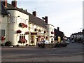
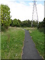
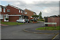
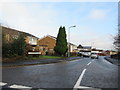
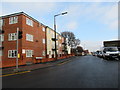
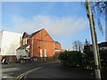
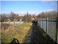
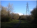
27 photos from this area
Area Information
Key information about the B71 2AQ including its size, population, and administrative classification.
- Area Type
- Postcode
- Area Size
- 6226 m²
- Population
- 1821
- Population Density
- 7319 people/km²
House Prices in B71 2AQ
16
Properties
£127,875
Average Sold Price
£37,000
Lowest Price
£255,000
Highest Price
Showing 16 properties
| Address | Type | Beds | Baths | Last Sale Price | Last Sale Date | |
|---|---|---|---|---|---|---|
| 106 Witton Lane, West Bromwich, B71 2AQ | Detached | 3 | 1 | £255,000 | Sep 2025 | |
| 84 Witton Lane, West Bromwich, B71 2AQ | Semi-detached | 3 | 1 | £94,000 | Feb 2019 | |
| 80 Witton Lane, West Bromwich, B71 2AQ | Semi-detached | 3 | 1 | £155,000 | May 2018 | |
| 96 Witton Lane, West Bromwich, B71 2AQ | Semi-detached | 4 | - | £145,000 | Jun 2017 | |
| 90 Witton Lane, West Bromwich, B71 2AQ | house | 3 | 2 | £120,000 | Jun 2015 | |
| 110 Witton Lane, West Bromwich, B71 2AQ | house | - | - | £120,000 | Jan 2013 | |
| 94 Witton Lane, West Bromwich, B71 2AQ | house | - | - | £97,000 | Mar 2009 | |
| 98 Witton Lane, West Bromwich, B71 2AQ | house | - | - | £37,000 | Jul 1999 | |
| 102 Witton Lane, West Bromwich, B71 2AQ | Semi-detached | 4 | - | - | - | |
| 108 Witton Lane, West Bromwich, B71 2AQ | Semi-detached | - | - | - | - |
Page 1 of 2
Energy Efficiency in B71 2AQ
Amenities
Schools
| Rank | School | Type | Entry gender | Ages |
|---|
Explore more schools in this area
Go to Schools tabDemographics
Household Size
Family (3-5 people)
most common
Accommodation Type
Houses
most common
Tenure
65
majority
Ethnic Group
White
most common
Religion
N/A
most common
Household Composition
N/A
most common
Age
47
median
Adults (30-64 years)
most common
Household Deprivation
N/A
with no deprivation
NS-SEC
16
in Lower managerial occupations
Explore more demographic insights in this area
Go to Demographics tabPlanning
Planning Constraints
- Flood RiskPremium
- Ramsar Wetland SitesPremium
- Area of Outstanding Natural BeautyPremium
- Protected Nature ReservePremium
- Protected WoodlandPremium