Area Overview for B70 9BA
Photos of B70 9BA
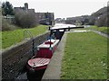

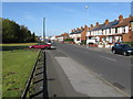
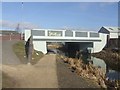
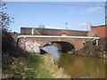


69 photos from this area
Area Information
Key information about the B70 9BA including its size, population, and administrative classification.
- Area Type
- Postcode
- Area Size
- 9875 m²
- Population
- 2068
- Population Density
- 1483 people/km²
House Prices in B70 9BA
32
Properties
£140,050
Average Sold Price
£25,000
Lowest Price
£287,000
Highest Price
Showing 32 properties
| Address | Type | Beds | Baths | Last Sale Price | Last Sale Date | |
|---|---|---|---|---|---|---|
| 18 Whitgreave Street, West Bromwich, B70 9BA | Semi-detached | 3 | 1 | £265,000 | Jun 2025 | |
| 16 Whitgreave Street, West Bromwich, B70 9BA | Semi-detached | 4 | 1 | £287,000 | Mar 2025 | |
| 30 Whitgreave Street, West Bromwich, B70 9BA | Semi-detached | 4 | 2 | £283,000 | Aug 2024 | |
| 38 Whitgreave Street, West Bromwich, B70 9BA | house | - | - | £230,000 | Apr 2024 | |
| 8 Whitgreave Street, West Bromwich, B70 9BA | Semi-detached | 3 | 1 | £230,000 | Jan 2023 | |
| 2 Whitgreave Street, West Bromwich, B70 9BA | Terraced | 3 | - | £202,000 | Jun 2021 | |
| 12 Whitgreave Street, West Bromwich, B70 9BA | Semi-detached | 4 | 1 | £195,000 | Nov 2020 | |
| 42 Whitgreave Street, West Bromwich, B70 9BA | house | 3 | - | £128,000 | Jun 2017 | |
| 48 Whitgreave Street, West Bromwich, B70 9BA | Terraced | 3 | - | £140,000 | Oct 2016 | |
| 22 Whitgreave Street, West Bromwich, B70 9BA | Terraced | 3 | 1 | £113,000 | Apr 2016 |
Page 1 of 4
Energy Efficiency in B70 9BA
Amenities
Schools
| Rank | School | Type | Entry gender | Ages |
|---|
Explore more schools in this area
Go to Schools tabDemographics
Household Size
Family (3-5 people)
most common
Accommodation Type
Houses
most common
Tenure
51
majority
Ethnic Group
White
most common
Religion
N/A
most common
Household Composition
N/A
most common
Age
47
median
Adults (30-64 years)
most common
Household Deprivation
N/A
with no deprivation
NS-SEC
15
in Lower managerial occupations
Explore more demographic insights in this area
Go to Demographics tabPlanning
Planning Constraints
- Flood RiskPremium
- Ramsar Wetland SitesPremium
- Area of Outstanding Natural BeautyPremium
- Protected Nature ReservePremium
- Protected WoodlandPremium