Area Overview for B70 0ER
Photos of B70 0ER
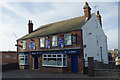
69 photos from this area
Area Information
Key information about the B70 0ER including its size, population, and administrative classification.
- Area Type
- Postcode
- Area Size
- 2.0 hectares
- Population
- 2068
- Population Density
- 1483 people/km²
House Prices in B70 0ER
50
Properties
£130,331
Average Sold Price
£40,000
Lowest Price
£295,000
Highest Price
Showing 50 properties
| Address | Type | Beds | Baths | Last Sale Price | Last Sale Date | |
|---|---|---|---|---|---|---|
| 31 Dunkirk Avenue, West Bromwich, B70 0ER | house | 4 | 1 | £252,000 | Nov 2023 | |
| 44 Dunkirk Avenue, West Bromwich, B70 0ER | Semi-detached | - | - | £175,000 | Nov 2023 | |
| 34 Dunkirk Avenue, West Bromwich, B70 0ER | Semi-detached | 2 | 1 | £177,000 | Sep 2023 | |
| 77 Dunkirk Avenue, West Bromwich, B70 0ER | house | - | - | £190,000 | Dec 2022 | |
| 79 Dunkirk Avenue, West Bromwich, B70 0ER | house | - | - | £155,000 | Dec 2022 | |
| 29 Dunkirk Avenue, West Bromwich, B70 0ER | Retail | 3 | 2 | £295,000 | Oct 2022 | |
| 61 Dunkirk Avenue, West Bromwich, B70 0ER | house | - | - | £210,000 | Jul 2022 | |
| 25 Dunkirk Avenue, West Bromwich, B70 0ER | Terraced | 3 | 1 | £175,000 | May 2021 | |
| 21 Dunkirk Avenue, West Bromwich, B70 0ER | house | 3 | - | £160,000 | Aug 2020 | |
| 30 Dunkirk Avenue, West Bromwich, B70 0ER | house | - | - | £139,000 | Mar 2018 |
Page 1 of 5
Energy Efficiency in B70 0ER
Amenities
Schools
| Rank | School | Type | Entry gender | Ages |
|---|
Explore more schools in this area
Go to Schools tabDemographics
Household Size
Family (3-5 people)
most common
Accommodation Type
Houses
most common
Tenure
51
majority
Ethnic Group
White
most common
Religion
N/A
most common
Household Composition
N/A
most common
Age
47
median
Adults (30-64 years)
most common
Household Deprivation
N/A
with no deprivation
NS-SEC
15
in Lower managerial occupations
Explore more demographic insights in this area
Go to Demographics tabPlanning
Planning Constraints
- Flood RiskPremium
- Ramsar Wetland SitesPremium
- Area of Outstanding Natural BeautyPremium
- Protected Nature ReservePremium
- Protected WoodlandPremium