Area Overview for B70 0SN
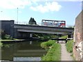
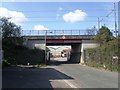
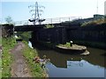
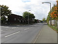
Photos of B70 0SN


Area Information
Living in B70 0SN means being part of a compact, densely populated residential cluster in the West Midlands. The area covers just 1.0 hectare, yet it accommodates 2,033 residents, giving it a population density of 197,905 people per square kilometre. This makes it one of the most densely inhabited places in England. Situated in Wednesbury, historically a market town with roots in medieval nail-making and coal mining, the area retains echoes of its industrial past while serving as a modern urban hub. The postcode falls within Sandwell borough, a unitary authority with a focus on urban development. Residents here are predominantly adults aged 30–64, with a median age of 47. The community is defined by its high home ownership rate and a strong presence of Asian residents, reflecting broader demographic trends in the region. Daily life is shaped by proximity to retail, transport, and historical sites, though the area’s small size means its character is tightly woven with the surrounding Wednesbury landscape.
- Area Type
- Postcode
- Area Size
- 1.0 hectares
- Population
- 2033
- Population Density
- 2236 people/km²
The property market in B70 0SN is characterised by a high home ownership rate of 64%, indicating that most properties are owner-occupied rather than rented. The area’s accommodation is predominantly houses, which is unusual for a small, densely populated postcode. This suggests a focus on single-family homes, possibly with gardens or larger living spaces, despite the area’s limited size. Given the compact nature of B70 0SN—covering just 1.0 hectare—the housing stock is likely to be tightly clustered, with limited scope for new developments. For buyers, this means competition for available properties, particularly given the area’s proximity to transport links and amenities. The high population density also implies that properties may be in high demand, though the small size of the area means that the immediate surroundings, such as Wednesbury, are likely to be key for expansion. Buyers should consider the area’s limitations in terms of space, as well as its strengths in connectivity and historical character.
House Prices in B70 0SN
No properties found in this postcode.
Energy Efficiency in B70 0SN
Residents of B70 0SN have access to a range of nearby amenities that support daily life. The area is within reach of five retail outlets, including Co-op Hill, Asda Great, and Morrisons Wednesbury, providing convenient shopping options for groceries and household essentials. For transport, five metro stops—Black Lake, Wednesbury Great Western Street, and Wednesbury Parkway—offer easy access to local and regional travel. Rail stations such as Dudley Port, Tame Bridge Parkway, and Bescot Stadium Railway Station further expand connectivity. While the area itself is small, its proximity to Wednesbury’s historical and commercial centres means residents can enjoy a blend of urban convenience and industrial heritage. The presence of multiple retail and transport options suggests a practical, accessible lifestyle, though the area’s compact size means that larger leisure or recreational facilities may be located slightly further afield.
Amenities
Schools
| Rank | School | Type | Entry gender | Ages |
|---|
Explore more schools in this area
Go to Schools tabDemographics
The community in B70 0SN is predominantly composed of adults aged 30–64, with a median age of 47. This suggests a mature population, likely with established careers and families. Home ownership is high at 64%, indicating a stable residential base, though the remaining 36% may include renters or second-home buyers. The area’s accommodation is largely composed of houses, reflecting a preference for single-family dwellings over flats or apartments. The predominant ethnic group is Asian, which aligns with broader patterns in the West Midlands. With a population density of 197,905 people per square kilometre, the area is intensely populated, which can influence local services and infrastructure. While no specific deprivation data is provided, the high population density and focus on home ownership suggest a mix of economic stability and potential challenges in resource allocation. The demographic profile indicates a community that values continuity and long-term residency, with a strong cultural presence from the Asian population.
Household Size
Accommodation Type
Tenure
Ethnic Group
Religion
Household Composition
Age
Household Deprivation
NS-SEC
Explore more demographic insights in this area
Go to Demographics tabPlanning
Planning Constraints
- Flood RiskPremium
- Ramsar Wetland SitesPremium
- Area of Outstanding Natural BeautyPremium
- Protected Nature ReservePremium
- Protected WoodlandPremium