Area Overview for B70 0TD
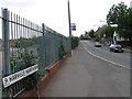
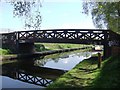
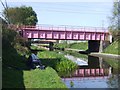
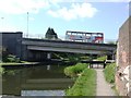
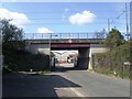
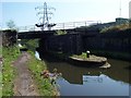
Photos of B70 0TD


Area Information
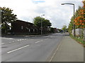
Living in B70 0TD means being part of a tightly knit residential cluster in the West Midlands, centred on Wednesbury’s historic market town. With a population of 2,094 and a density of 1,673 people per square kilometre, this area is compact yet rich in local character. Its roots trace back to medieval times, with a legacy of coal mining and nail-making industries shaping its identity. Today, it sits within Sandwell borough, a unitary authority known for its urban development. The area’s proximity to B70 0DY and its integration into modern infrastructure make it a practical choice for those seeking a balance between historical charm and contemporary convenience. Daily life here is defined by its proximity to retail hubs, rail networks, and schools, while the surrounding landscape reflects a mix of industrial heritage and residential tranquility. For buyers, B70 0TD offers a snapshot of a community where tradition meets accessibility, with a focus on practical living rather than sprawling suburbia.
- Area Type
- Postcode
- Area Size
- Not available
- Population
- 2094
- Population Density
- 1673 people/km²
The property market in B70 0TD is characterised by a 43% home ownership rate, indicating that less than half of properties are owner-occupied, with the remainder likely in the rental sector. The accommodation type is predominantly houses, which contrasts with areas where flats dominate. This suggests a housing stock skewed towards larger, more traditional homes, possibly appealing to families or those seeking space. However, the small area’s limited size means the housing stock is unlikely to be extensive. Buyers should consider that the market may cater more to renters or those purchasing second homes rather than first-time buyers seeking starter properties. The absence of specific data on property prices or availability means the market’s dynamics remain opaque, but the focus on houses implies a niche appeal for those prioritising space over density.
House Prices in B70 0TD
No properties found in this postcode.
Energy Efficiency in B70 0TD
The lifestyle in B70 0TD is shaped by its proximity to retail, dining, and transport hubs. Within reach are five retail outlets, including Co-op Hill and Morrisons Wednesbury, providing everyday shopping convenience. The area’s metro and rail stations, such as Wednesbury Parkway and Bescot Stadium, connect residents to broader networks for commuting or leisure. While the data does not mention parks or green spaces, the absence of protected natural sites suggests a focus on urban living. The presence of multiple schools and retail options indicates a community-oriented environment, where daily errands and social activities are easily accessible. Dining options are not specified, but the retail diversity implies a range of local services. Overall, B70 0TD offers a practical, connected lifestyle with a balance of essential amenities and transport links.
Amenities
Schools
Residents of B70 0TD have access to three primary schools within the area: Harvills Hawthorn Infant and Nursery School, Harvills Hawthorn Junior School, and Harvills Hawthorn Primary School, which holds an Ofsted rating of outstanding. These institutions collectively cater to early years education through primary schooling, offering a comprehensive foundation for young learners. The presence of both infant and junior schools suggests a structured approach to education, with the outstanding-rated primary school likely providing a high standard of teaching. For families, this cluster of schools ensures proximity to educational needs without the need for long commutes. However, the absence of secondary schools in the data means parents may need to look beyond the immediate area for further education. The school mix reflects a focus on early education, aligning with the community’s demographic of middle-aged adults.
| Rank | School | Type | Entry gender | Ages |
|---|
Explore more schools in this area
Go to Schools tabDemographics
The population of B70 0TD is predominantly adults aged 30–64, with a median age of 47. This suggests a community rooted in middle-aged households, likely with established careers and family structures. Home ownership sits at 43%, indicating a mix of owner-occupied properties and rental tenancies. The accommodation type is largely houses, reflecting a preference for detached or semi-detached homes over flats. The predominant ethnic group is White, with no specific data on other demographics provided. This profile aligns with a mature, stable population, though the relatively low home ownership rate may suggest a higher proportion of renters. The area’s density and age distribution imply a focus on functional, family-oriented living, with limited data on deprivation levels. However, the absence of protected natural sites or planning constraints suggests a practical, unencumbered environment for residents.
Household Size
Accommodation Type
Tenure
Ethnic Group
Religion
Household Composition
Age
Household Deprivation
NS-SEC
Explore more demographic insights in this area
Go to Demographics tabPlanning
Planning Constraints
- Flood RiskPremium
- Ramsar Wetland SitesPremium
- Area of Outstanding Natural BeautyPremium
- Protected Nature ReservePremium
- Protected WoodlandPremium