Area Overview for B70 0EJ
Photos of B70 0EJ


Area Information
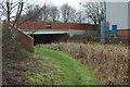
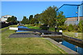
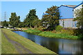
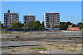
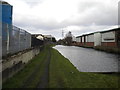
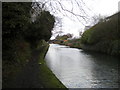
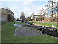
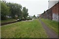
Living in B70 0EJ means inhabiting a compact, historically rooted area within the Metropolitan Borough of Sandwell. This postcode covers 8,795 square metres and is home to 2,068 people, making it a densely populated yet small-scale community. Situated near Dudley, West Bromwich, and Wednesbury, it lies along the River Tame and Walsall Canal, with a mix of residential and commercial spaces. The area’s origins trace back to a gravelly stream crossed by a bridge, reflecting its industrial past. Today, it balances heritage with modern amenities, including a 24-hour Asda superstore on a former factory site and nearby rail links. Daily life here is shaped by its proximity to transport routes like the Black Country Spine Road, which connects to Bilston, Wednesbury, and the M5 motorway. While the area has seen de-industrialisation since the 1990s, it remains a functional hub with retail, dining, and public transport options within reach. Its compact size means residents are close to schools, shops, and transit, though the high population density influences the character of the neighbourhood.
- Area Type
- Postcode
- Area Size
- 8795 m²
- Population
- 2068
- Population Density
- 1483 people/km²
The property market in B70 0EJ is dominated by houses, with 51% of residents owning their homes. This suggests a stable, owner-occupied market rather than a high-rental area. The prevalence of houses, as opposed to flats or apartments, indicates a preference for standalone properties, which may appeal to families or those seeking more space. However, the small area size and high population density mean that housing stock is limited, and the immediate surroundings are likely to be similarly constrained. Buyers should consider that the area’s compact nature may limit availability, particularly for larger homes. The historical industrial background has left a legacy of commercial and industrial properties, some of which have been repurposed, such as the Asda superstore on a former factory site. For prospective buyers, this mix of housing types and the proximity to transport links could be advantageous, though competition for properties may be keen due to the area’s limited size.
House Prices in B70 0EJ
No properties found in this postcode.
Energy Efficiency in B70 0EJ
Life in B70 0EJ is characterised by proximity to a range of amenities that cater to daily needs. The area includes five retail outlets, such as Asda Great and Lidl Tipton, ensuring access to groceries and household essentials. For leisure and transport, residents can use metro stops like Black Lake and Dartmouth Street, alongside rail stations such as Dudley Port and Sandwell & Dudley Railway Station. The Walsall Canal and River Tame provide green spaces, with a pedestrian footpath linking the town centre to the Asda site, offering a rare blend of natural and commercial environments. The presence of a 24-hour Asda superstore, once a factory, highlights the area’s adaptability, while the Wilko store in the old village centre adds to the retail mix. These amenities contribute to a functional lifestyle, though the compact nature of the area means that choices are limited to nearby options. The blend of retail, transport, and green spaces supports a practical, community-oriented way of life.
Amenities
Schools
The nearest school to B70 0EJ is Newtown Primary School, which serves the local community and holds an Ofsted rating of ‘good’. This school is the only educational institution listed in the data, indicating that primary education is accessible within the area. Families relying on this school may benefit from its proximity, though the absence of secondary schools or additional educational facilities within the postcode suggests that residents may need to travel to nearby towns for higher education. The ‘good’ rating implies that the school meets national standards, though it does not provide detailed insights into specific academic performance or facilities. For parents prioritising school quality, the availability of a rated primary school is a positive factor, though the lack of diversity in educational options may be a consideration for those requiring a broader range of schools.
| Rank | School | Type | Entry gender | Ages |
|---|
Explore more schools in this area
Go to Schools tabDemographics
B70 0EJ has a median age of 47, with the majority of residents aged 30–64. This suggests a community of established professionals and families, rather than a younger or elderly demographic. Home ownership rates stand at 51%, indicating a balanced mix of owner-occupied and rental properties. The area is predominantly composed of houses, which contrasts with higher-density housing types. The predominant ethnic group is White, reflecting the broader demographic patterns of the West Midlands. With a population density of 1,483 people per square kilometre, the area is tightly packed, which can influence social dynamics and local services. This density also means that amenities and transport options are closely spaced, though it may contribute to a sense of community cohesion. The data does not indicate significant deprivation levels, but the high population density and historical industrial legacy suggest a pragmatic, working-class character to the area.
Household Size
Accommodation Type
Tenure
Ethnic Group
Religion
Household Composition
Age
Household Deprivation
NS-SEC
Explore more demographic insights in this area
Go to Demographics tabPlanning
Planning Constraints
- Flood RiskPremium
- Ramsar Wetland SitesPremium
- Area of Outstanding Natural BeautyPremium
- Protected Nature ReservePremium
- Protected WoodlandPremium