Area Overview for B69 2GB
Photos of B69 2GB
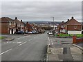
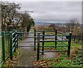
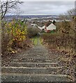
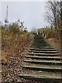
31 photos from this area
Area Information
Key information about the B69 2GB including its size, population, and administrative classification.
- Area Type
- Postcode
- Area Size
- 8471 m²
- Population
- 2441
- Population Density
- 1643 people/km²
House Prices in B69 2GB
23
Properties
£152,271
Average Sold Price
£93,100
Lowest Price
£245,000
Highest Price
Showing 23 properties
| Address | Type | Beds | Baths | Last Sale Price | Last Sale Date | |
|---|---|---|---|---|---|---|
| 15 Regan Drive, Oldbury, B69 2GB | Terraced | 3 | 1 | £220,000 | Nov 2025 | |
| 3 Regan Drive, Oldbury, B69 2GB | Detached | 3 | 1 | £227,500 | Apr 2023 | |
| 17 Regan Drive, Oldbury, B69 2GB | Detached | 3 | 2 | £232,000 | Jul 2022 | |
| 16 Regan Drive, Oldbury, B69 2GB | Terraced | 2 | 2 | £142,000 | Aug 2020 | |
| 20 Regan Drive, Oldbury, B69 2GB | house | 3 | 1 | £140,000 | May 2020 | |
| 25 Regan Drive, Oldbury, B69 2GB | Terraced | 2 | 1 | £137,000 | Feb 2020 | |
| 27 Regan Drive, Oldbury, B69 2GB | Terraced | 2 | 1 | £135,000 | Aug 2018 | |
| 2 Regan Drive, Oldbury, B69 2GB | Detached | 4 | 2 | £245,000 | May 2018 | |
| 14 Regan Drive, Oldbury, B69 2GB | Detached | 3 | - | £157,500 | Aug 2015 | |
| 18 Regan Drive, Oldbury, B69 2GB | Terraced | 2 | 1 | £98,000 | May 2011 |
Page 1 of 3
Energy Efficiency in B69 2GB
Amenities
Schools
| Rank | School | Type | Entry gender | Ages |
|---|
Explore more schools in this area
Go to Schools tabDemographics
Household Size
One person
most common
Accommodation Type
Houses
most common
Tenure
56
majority
Ethnic Group
White
most common
Religion
N/A
most common
Household Composition
N/A
most common
Age
47
median
Adults (30-64 years)
most common
Household Deprivation
N/A
with no deprivation
NS-SEC
26
in Lower managerial occupations
Explore more demographic insights in this area
Go to Demographics tabPlanning
Planning Constraints
- Flood RiskPremium
- Ramsar Wetland SitesPremium
- Area of Outstanding Natural BeautyPremium
- Protected Nature ReservePremium
- Protected WoodlandPremium