Area Overview for B69 2DZ
Photos of B69 2DZ
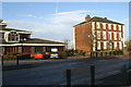


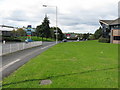

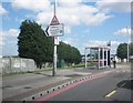


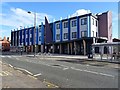
65 photos from this area
Area Information
Key information about the B69 2DZ including its size, population, and administrative classification.
- Area Type
- Postcode
- Area Size
- 9966 m²
- Population
- 2441
- Population Density
- 1643 people/km²
House Prices in B69 2DZ
49
Properties
£109,595
Average Sold Price
£27,500
Lowest Price
£305,000
Highest Price
Showing 49 properties
| Address | Type | Beds | Baths | Last Sale Price | Last Sale Date | |
|---|---|---|---|---|---|---|
| 75 Dingle Street, Oldbury, B69 2DZ | Terraced | 2 | 1 | £176,000 | Feb 2023 | |
| 93 Dingle Street, Oldbury, B69 2DZ | Retail | 5 | 2 | £305,000 | May 2022 | |
| 41 Dingle Street, Oldbury, B69 2DZ | Retail | 4 | 1 | £180,000 | May 2022 | |
| 15 Dingle Street, Oldbury, B69 2DZ | house | - | - | £130,000 | May 2021 | |
| 97 Dingle Street, Oldbury, B69 2DZ | Semi-detached | 2 | 1 | £110,000 | Oct 2020 | |
| 85 Dingle Street, Oldbury, B69 2DZ | Detached | 3 | 1 | £247,000 | Sep 2020 | |
| 17 Dingle Street, Oldbury, B69 2DZ | house | - | - | £112,000 | May 2020 | |
| 95 Dingle Street, Oldbury, B69 2DZ | Maisonette | 2 | 1 | £98,000 | Oct 2019 | |
| 101 Dingle Street, Oldbury, B69 2DZ | Maisonette | - | - | £83,000 | Sep 2019 | |
| 49 Dingle Street, Oldbury, B69 2DZ | Semi-detached | 3 | 1 | £120,000 | May 2018 |
Page 1 of 5
Energy Efficiency in B69 2DZ
Amenities
Schools
| Rank | School | Type | Entry gender | Ages |
|---|
Explore more schools in this area
Go to Schools tabDemographics
Household Size
One person
most common
Accommodation Type
Houses
most common
Tenure
56
majority
Ethnic Group
White
most common
Religion
N/A
most common
Household Composition
N/A
most common
Age
47
median
Adults (30-64 years)
most common
Household Deprivation
N/A
with no deprivation
NS-SEC
26
in Lower managerial occupations
Explore more demographic insights in this area
Go to Demographics tabPlanning
Planning Constraints
- Flood RiskPremium
- Ramsar Wetland SitesPremium
- Area of Outstanding Natural BeautyPremium
- Protected Nature ReservePremium
- Protected WoodlandPremium