Area Overview for B69 1BA
Photos of B69 1BA
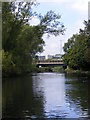
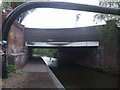
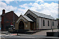
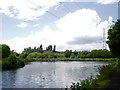
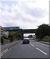
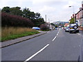
47 photos from this area
Area Information
Key information about the B69 1BA including its size, population, and administrative classification.
- Area Type
- Postcode
- Area Size
- 7803 m²
- Population
- 2370
- Population Density
- 8810 people/km²
House Prices in B69 1BA
43
Properties
£114,925
Average Sold Price
£67,000
Lowest Price
£196,000
Highest Price
Showing 43 properties
| Address | Type | Beds | Baths | Last Sale Price | Last Sale Date | |
|---|---|---|---|---|---|---|
| 48 Westgate, Oldbury, B69 1BA | Terraced | 3 | 1 | £177,500 | Oct 2024 | |
| 15 Westgate, Oldbury, B69 1BA | Terraced | 3 | 1 | £170,000 | Sep 2023 | |
| 42 Westgate, Oldbury, B69 1BA | house | - | - | £196,000 | Nov 2022 | |
| 19 Westgate, Oldbury, B69 1BA | house | - | - | £105,000 | Aug 2020 | |
| 14 Westgate, Oldbury, B69 1BA | Terraced | 3 | 1 | £132,000 | Mar 2019 | |
| 38 Westgate, Oldbury, B69 1BA | Terraced | 3 | 1 | £115,000 | Mar 2019 | |
| 40 Westgate, Oldbury, B69 1BA | Terraced | 3 | 1 | £133,000 | Nov 2018 | |
| 44 Westgate, Oldbury, B69 1BA | Terraced | 3 | 1 | £109,950 | Oct 2015 | |
| 29 Westgate, Oldbury, B69 1BA | house | - | - | £86,000 | Apr 2013 | |
| 17 Westgate, Oldbury, B69 1BA | Terraced | - | - | £92,000 | Jun 2006 |
Page 1 of 5
Energy Efficiency in B69 1BA
Amenities
Schools
| Rank | School | Type | Entry gender | Ages |
|---|
Explore more schools in this area
Go to Schools tabDemographics
Household Size
One person
most common
Accommodation Type
Flats
most common
Tenure
37
majority
Ethnic Group
White
most common
Religion
N/A
most common
Household Composition
N/A
most common
Age
47
median
Adults (30-64 years)
most common
Household Deprivation
N/A
with no deprivation
NS-SEC
20
in Lower managerial occupations
Explore more demographic insights in this area
Go to Demographics tabPlanning
Planning Constraints
- Flood RiskPremium
- Ramsar Wetland SitesPremium
- Area of Outstanding Natural BeautyPremium
- Protected Nature ReservePremium
- Protected WoodlandPremium