Area Overview for B69 1AX
Photos of B69 1AX

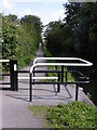


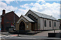


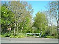


47 photos from this area
Area Information
Key information about the B69 1AX including its size, population, and administrative classification.
- Area Type
- Postcode
- Area Size
- 2441 m²
- Population
- 2370
- Population Density
- 8810 people/km²
House Prices in B69 1AX
15
Properties
£111,390
Average Sold Price
£53,950
Lowest Price
£185,000
Highest Price
Showing 15 properties
| Address | Type | Beds | Baths | Last Sale Price | Last Sale Date | |
|---|---|---|---|---|---|---|
| 99 Borough Crescent, Oldbury, B69 1AX | Maisonette | 1 | 1 | £60,000 | Mar 2025 | |
| 32 Borough Crescent, Oldbury, B69 1AX | Semi-detached | 3 | 1 | £185,000 | Jul 2023 | |
| 91 Borough Crescent, Oldbury, B69 1AX | Terraced | 3 | 1 | £122,000 | May 2019 | |
| 34 Borough Crescent, Oldbury, B69 1AX | Semi-detached | 3 | 1 | £136,000 | May 2018 | |
| 38 Borough Crescent, Oldbury, B69 1AX | Semi-detached | - | - | £53,950 | Dec 2000 | |
| 93 Borough Crescent, Oldbury, B69 1AX | Terraced | 3 | 2 | - | - | |
| 36 Borough Crescent, Oldbury, B69 1AX | house | - | - | - | - | |
| 87 Borough Crescent, Oldbury, B69 1AX | Flat | - | - | - | - | |
| 89 Borough Crescent, Oldbury, B69 1AX | Flat | - | - | - | - | |
| 101 Borough Crescent, Oldbury, B69 1AX | Flat | - | - | - | - |
Page 1 of 2
Energy Efficiency in B69 1AX
Amenities
Schools
| Rank | School | Type | Entry gender | Ages |
|---|
Explore more schools in this area
Go to Schools tabDemographics
Household Size
One person
most common
Accommodation Type
Flats
most common
Tenure
37
majority
Ethnic Group
White
most common
Religion
N/A
most common
Household Composition
N/A
most common
Age
47
median
Adults (30-64 years)
most common
Household Deprivation
N/A
with no deprivation
NS-SEC
20
in Lower managerial occupations
Explore more demographic insights in this area
Go to Demographics tabPlanning
Planning Constraints
- Flood RiskPremium
- Ramsar Wetland SitesPremium
- Area of Outstanding Natural BeautyPremium
- Protected Nature ReservePremium
- Protected WoodlandPremium