Area Overview for B68 0SU
Photos of B68 0SU
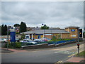
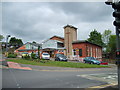
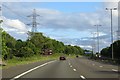
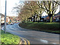

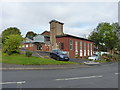
19 photos from this area
Area Information
Key information about the B68 0SU including its size, population, and administrative classification.
- Area Type
- Postcode
- Area Size
- 7845 m²
- Population
- 1586
- Population Density
- 8269 people/km²
House Prices in B68 0SU
30
Properties
£141,882
Average Sold Price
£36,950
Lowest Price
£223,000
Highest Price
Showing 30 properties
| Address | Type | Beds | Baths | Last Sale Price | Last Sale Date | |
|---|---|---|---|---|---|---|
| 87 Brennand Road, Oldbury, B68 0SU | Terraced | 3 | 1 | £218,000 | Oct 2024 | |
| 85 Brennand Road, Oldbury, B68 0SU | Terraced | 3 | 1 | £205,000 | Jun 2023 | |
| 73 Brennand Road, Oldbury, B68 0SU | Terraced | 4 | 1 | £223,000 | Sep 2022 | |
| 63 Brennand Road, Oldbury, B68 0SU | Retail | 3 | 1 | £191,500 | Apr 2022 | |
| 95 Brennand Road, Oldbury, B68 0SU | Detached | 4 | 2 | £185,000 | Dec 2021 | |
| 55 Brennand Road, Oldbury, B68 0SU | Terraced | 4 | - | £64,800 | Jul 2021 | |
| 93 Brennand Road, Oldbury, B68 0SU | house | 4 | 1 | £128,000 | Mar 2018 | |
| 91 Brennand Road, Oldbury, B68 0SU | house | - | - | £93,500 | Mar 2013 | |
| 43 Brennand Road, Oldbury, B68 0SU | Semi-detached | 3 | 1 | £115,000 | Jun 2008 | |
| 83 Brennand Road, Oldbury, B68 0SU | Semi-detached | 3 | 1 | £99,950 | May 2007 |
Page 1 of 3
Energy Efficiency in B68 0SU
Amenities
Schools
| Rank | School | Type | Entry gender | Ages |
|---|
Explore more schools in this area
Go to Schools tabDemographics
Household Size
Family (3-5 people)
most common
Accommodation Type
Houses
most common
Tenure
52
majority
Ethnic Group
White
most common
Religion
N/A
most common
Household Composition
N/A
most common
Age
47
median
Adults (30-64 years)
most common
Household Deprivation
N/A
with no deprivation
NS-SEC
21
in Lower managerial occupations
Explore more demographic insights in this area
Go to Demographics tabPlanning
Planning Constraints
- Flood RiskPremium
- Ramsar Wetland SitesPremium
- Area of Outstanding Natural BeautyPremium
- Protected Nature ReservePremium
- Protected WoodlandPremium