Area Overview for B68 0PN
Photos of B68 0PN
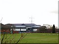
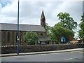


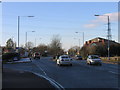
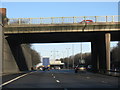
39 photos from this area
Area Information
Key information about the B68 0PN including its size, population, and administrative classification.
- Area Type
- Postcode
- Area Size
- 2.8 hectares
- Population
- 1575
- Population Density
- 4000 people/km²
House Prices in B68 0PN
38
Properties
£131,968
Average Sold Price
£43,500
Lowest Price
£231,500
Highest Price
Showing 38 properties
| Address | Type | Beds | Baths | Last Sale Price | Last Sale Date | |
|---|---|---|---|---|---|---|
| 732 Hagley Road West, Oldbury, B68 0PN | Detached | 3 | 1 | £229,950 | Feb 2020 | |
| 690 Hagley Road West, Oldbury, B68 0PN | Semi-detached | 3 | 1 | £162,500 | Jul 2019 | |
| 718 Hagley Road West, Oldbury, B68 0PN | Semi-detached | 3 | 1 | £159,950 | Mar 2018 | |
| 728 Hagley Road West, Oldbury, B68 0PN | house | - | - | £205,000 | Nov 2017 | |
| 702 Hagley Road West, Oldbury, B68 0PN | Semi-detached | 3 | 1 | £130,000 | Jul 2017 | |
| 696 Hagley Road West, Oldbury, B68 0PN | Semi-detached | 3 | 1 | £60,000 | May 2017 | |
| 736 Hagley Road West, Oldbury, B68 0PN | house | - | - | £231,500 | Mar 2017 | |
| 716 Hagley Road West, Oldbury, B68 0PN | Semi-detached | 3 | 1 | £159,950 | Dec 2016 | |
| 688 Hagley Road West, Oldbury, B68 0PN | Semi-detached | 3 | 1 | £148,000 | Oct 2016 | |
| 708 Hagley Road West, Oldbury, B68 0PN | house | - | - | £100,000 | Aug 2016 |
Page 1 of 4
Energy Efficiency in B68 0PN
Amenities
Schools
| Rank | School | Type | Entry gender | Ages |
|---|
Explore more schools in this area
Go to Schools tabDemographics
Household Size
Family (3-5 people)
most common
Accommodation Type
Houses
most common
Tenure
85
majority
Ethnic Group
White
most common
Religion
N/A
most common
Household Composition
N/A
most common
Age
47
median
Adults (30-64 years)
most common
Household Deprivation
N/A
with no deprivation
NS-SEC
32
in Lower managerial occupations
Explore more demographic insights in this area
Go to Demographics tabPlanning
Planning Constraints
- Flood RiskPremium
- Ramsar Wetland SitesPremium
- Area of Outstanding Natural BeautyPremium
- Protected Nature ReservePremium
- Protected WoodlandPremium