Area Overview for B32 1DH
Photos of B32 1DH

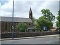


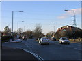
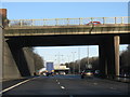

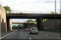

39 photos from this area
Area Information
Key information about the B32 1DH including its size, population, and administrative classification.
- Area Type
- Postcode
- Area Size
- 1.1 hectares
- Population
- 1602
- Population Density
- 4213 people/km²
House Prices in B32 1DH
20
Properties
£212,500
Average Sold Price
£115,000
Lowest Price
£385,000
Highest Price
Showing 20 properties
| Address | Type | Beds | Baths | Last Sale Price | Last Sale Date | |
|---|---|---|---|---|---|---|
| 691 Hagley Road West, Birmingham, B32 1DH | Semi-detached | 3 | 1 | £275,000 | Jul 2024 | |
| 689 Hagley Road West, Birmingham, B32 1DH | house | - | - | £260,000 | May 2024 | |
| 675 Hagley Road West, Birmingham, B32 1DH | Semi-detached | 3 | 1 | £272,000 | Dec 2023 | |
| 703 Hagley Road West, Birmingham, B32 1DH | Bungalow | - | - | £385,000 | Nov 2020 | |
| 665 Hagley Road West, Birmingham, B32 1DH | Semi-detached | 3 | - | £200,000 | Sep 2016 | |
| 701 Hagley Road West, Birmingham, B32 1DH | house | - | - | £210,000 | Aug 2016 | |
| 669 Hagley Road West, Birmingham, B32 1DH | Semi-detached | 3 | - | £147,000 | Dec 2014 | |
| 685 Hagley Road West, Birmingham, B32 1DH | Semi-detached | 3 | 1 | £125,000 | Aug 2013 | |
| 667 Hagley Road West, Birmingham, B32 1DH | Semi-detached | - | - | £136,000 | Nov 2002 | |
| 693 Hagley Road West, Birmingham, B32 1DH | Semi-detached | - | - | £115,000 | Mar 2002 |
Page 1 of 2
Energy Efficiency in B32 1DH
Amenities
Schools
| Rank | School | Type | Entry gender | Ages |
|---|
Explore more schools in this area
Go to Schools tabDemographics
Household Size
Family (3-5 people)
most common
Accommodation Type
Houses
most common
Tenure
76
majority
Ethnic Group
White
most common
Religion
N/A
most common
Household Composition
N/A
most common
Age
47
median
Adults (30-64 years)
most common
Household Deprivation
N/A
with no deprivation
NS-SEC
36
in Lower managerial occupations
Explore more demographic insights in this area
Go to Demographics tabPlanning
Planning Constraints
- Flood RiskPremium
- Ramsar Wetland SitesPremium
- Area of Outstanding Natural BeautyPremium
- Protected Nature ReservePremium
- Protected WoodlandPremium