Area Overview for B68 0NA
Photos of B68 0NA
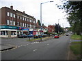
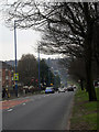
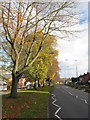
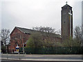
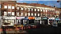
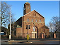
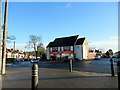
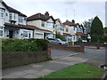
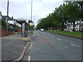
25 photos from this area
Area Information
Key information about the B68 0NA including its size, population, and administrative classification.
- Area Type
- Postcode
- Area Size
- 1.2 hectares
- Population
- 1619
- Population Density
- 4678 people/km²
House Prices in B68 0NA
23
Properties
£168,731
Average Sold Price
£55,000
Lowest Price
£299,000
Highest Price
Showing 23 properties
| Address | Type | Beds | Baths | Last Sale Price | Last Sale Date | |
|---|---|---|---|---|---|---|
| 15 Albert Road, Oldbury, B68 0NA | Semi-detached | 3 | 1 | £255,000 | May 2023 | |
| 30 Albert Road, Oldbury, B68 0NA | Semi-detached | 3 | 1 | £242,000 | Jun 2020 | |
| 27 Albert Road, Oldbury, B68 0NA | Semi-detached | 4 | 2 | £299,000 | Feb 2019 | |
| 5 Albert Road, Oldbury, B68 0NA | Semi-detached | 3 | 1 | £233,000 | Jan 2019 | |
| 3 Albert Road, Oldbury, B68 0NA | Semi-detached | 3 | 2 | £211,500 | May 2018 | |
| 23 Albert Road, Oldbury, B68 0NA | Detached | 3 | 2 | £190,000 | Aug 2017 | |
| 20 Albert Road, Oldbury, B68 0NA | Semi-detached | 3 | 1 | £224,950 | Apr 2017 | |
| 28 Albert Road, Oldbury, B68 0NA | Semi-detached | 3 | - | £180,000 | Oct 2015 | |
| 1A Albert Road, Oldbury, B68 0NA | Detached | 5 | - | £165,000 | Nov 2013 | |
| 21 Albert Road, Oldbury, B68 0NA | house | 3 | - | £140,000 | Aug 2012 |
Page 1 of 3
Energy Efficiency in B68 0NA
Amenities
Schools
| Rank | School | Type | Entry gender | Ages |
|---|
Explore more schools in this area
Go to Schools tabDemographics
Household Size
Family (3-5 people)
most common
Accommodation Type
Houses
most common
Tenure
82
majority
Ethnic Group
White
most common
Religion
N/A
most common
Household Composition
N/A
most common
Age
47
median
Adults (30-64 years)
most common
Household Deprivation
N/A
with no deprivation
NS-SEC
36
in Lower managerial occupations
Explore more demographic insights in this area
Go to Demographics tabPlanning
Planning Constraints
- Flood RiskPremium
- Ramsar Wetland SitesPremium
- Area of Outstanding Natural BeautyPremium
- Protected Nature ReservePremium
- Protected WoodlandPremium