Area Overview for B67 7JZ
Photos of B67 7JZ
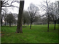
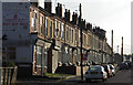
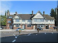
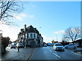
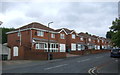
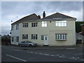
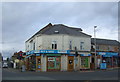
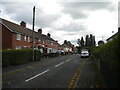
24 photos from this area
Area Information
Key information about the B67 7JZ including its size, population, and administrative classification.
- Area Type
- Postcode
- Area Size
- 2523 m²
- Population
- 2150
- Population Density
- 2184 people/km²
House Prices in B67 7JZ
8
Properties
£106,833
Average Sold Price
£40,000
Lowest Price
£190,000
Highest Price
Showing 8 properties
| Address | Type | Beds | Baths | Last Sale Price | Last Sale Date | |
|---|---|---|---|---|---|---|
| 115 Holly Lane, Smethwick, B67 7JZ | Detached | 3 | 1 | £190,000 | Nov 2019 | |
| 119 Holly Lane, Smethwick, B67 7JZ | house | 3 | - | £106,000 | Feb 2012 | |
| 118 Holly Lane, Smethwick, B67 7JZ | house | - | - | £95,000 | Jan 2012 | |
| 117 Holly Lane, Smethwick, B67 7JZ | house | 3 | 1 | £147,000 | Jun 2006 | |
| 121 Holly Lane, Smethwick, B67 7JZ | house | - | - | £40,000 | Dec 1999 | |
| 122 Holly Lane, Smethwick, B67 7JZ | Semi-detached | - | - | £63,000 | Sep 1999 | |
| 120 Holly Lane, Smethwick, B67 7JZ | Semi-detached | - | - | - | - | |
| 116 Holly Lane, Smethwick, B67 7JZ | Detached | - | - | - | - |
Energy Efficiency in B67 7JZ
Amenities
Schools
| Rank | School | Type | Entry gender | Ages |
|---|
Explore more schools in this area
Go to Schools tabDemographics
Household Size
Family (3-5 people)
most common
Accommodation Type
Houses
most common
Tenure
55
majority
Ethnic Group
asian_total
most common
Religion
N/A
most common
Household Composition
N/A
most common
Age
47
median
Adults (30-64 years)
most common
Household Deprivation
N/A
with no deprivation
NS-SEC
13
in Lower managerial occupations
Explore more demographic insights in this area
Go to Demographics tabPlanning
Planning Constraints
- Flood RiskPremium
- Ramsar Wetland SitesPremium
- Area of Outstanding Natural BeautyPremium
- Protected Nature ReservePremium
- Protected WoodlandPremium