Area Overview for B67 6BY
Photos of B67 6BY
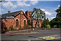
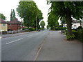
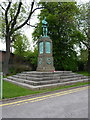


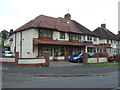
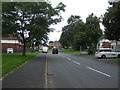


20 photos from this area
Area Information
Key information about the B67 6BY including its size, population, and administrative classification.
- Area Type
- Postcode
- Area Size
- 3438 m²
- Population
- 2018
- Population Density
- 14666 people/km²
House Prices in B67 6BY
21
Properties
£98,875
Average Sold Price
£27,000
Lowest Price
£195,000
Highest Price
Showing 21 properties
| Address | Type | Beds | Baths | Last Sale Price | Last Sale Date | |
|---|---|---|---|---|---|---|
| 75 The Uplands, Smethwick, B67 6BY | Terraced | 3 | 1 | £170,000 | Jun 2024 | |
| 69 The Uplands, Smethwick, B67 6BY | Terraced | 2 | 1 | £195,000 | Oct 2023 | |
| 67 The Uplands, Smethwick, B67 6BY | Terraced | - | - | £171,000 | Dec 2022 | |
| 51 The Uplands, Smethwick, B67 6BY | house | - | - | £130,000 | Mar 2022 | |
| 65 The Uplands, Smethwick, B67 6BY | house | - | - | £140,000 | Apr 2021 | |
| 61 The Uplands, Smethwick, B67 6BY | house | - | - | £125,000 | Mar 2021 | |
| 57 The Uplands, Smethwick, B67 6BY | Terraced | 2 | - | £93,000 | Sep 2017 | |
| 55 The Uplands, Smethwick, B67 6BY | Terraced | 2 | 1 | £90,000 | Jun 2016 | |
| 49 The Uplands, Smethwick, B67 6BY | Terraced | 2 | 1 | £68,000 | Jan 2013 | |
| 73 The Uplands, Smethwick, B67 6BY | house | 3 | - | £104,500 | Oct 2010 |
Page 1 of 3
Energy Efficiency in B67 6BY
Amenities
Schools
| Rank | School | Type | Entry gender | Ages |
|---|
Explore more schools in this area
Go to Schools tabDemographics
Household Size
Family (3-5 people)
most common
Accommodation Type
Houses
most common
Tenure
48
majority
Ethnic Group
asian_total
most common
Religion
N/A
most common
Household Composition
N/A
most common
Age
47
median
Adults (30-64 years)
most common
Household Deprivation
N/A
with no deprivation
NS-SEC
14
in Lower managerial occupations
Explore more demographic insights in this area
Go to Demographics tabPlanning
Planning Constraints
- Flood RiskPremium
- Ramsar Wetland SitesPremium
- Area of Outstanding Natural BeautyPremium
- Protected Nature ReservePremium
- Protected WoodlandPremium