Area Overview for B67 6BF
Photos of B67 6BF


Area Information
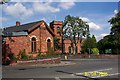
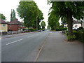
Living in B67 6BF means being part of a small residential cluster in England, where the population of 2018 residents reflects a tightly knit community. This area is historically rooted in Smethwick, a town with a legacy of industrial innovation, including the Soho Foundry and early gas lighting experiments. While the postcode covers a compact space, it sits within a region that once straddled Staffordshire and Worcestershire before becoming part of the West Midlands. Daily life here is shaped by its proximity to Birmingham, just 4 miles east, offering easy access to urban amenities without the city’s density. The area’s character blends modest housing with a history of engineering and transport, from canals to railways. With rail stations like Smethwick Rolfe Street and Hawthorns within reach, residents enjoy connectivity to nearby towns and cities. The median age of 47 suggests a stable population, with many residents in their prime working years, contributing to a practical, community-focused atmosphere.
- Area Type
- Postcode
- Area Size
- Not available
- Population
- 2018
- Population Density
- 14666 people/km²
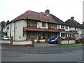
The property market in B67 6BF is characterised by a 48% home ownership rate, with houses making up the majority of accommodation types. This suggests a market skewed towards owner-occupied homes rather than a high proportion of rental properties. Given the area’s small size, the housing stock is likely limited to a few hundred properties, with limited scope for expansion. The predominance of houses over flats or apartments indicates a preference for single-family living, which may appeal to those seeking space and privacy. For buyers, this means competition could be fierce, particularly for properties in good condition. The small postcode area also means that proximity to amenities and transport is a key factor in property value. Investors should consider the local demand, which may be driven by commuters relying on nearby rail and metro links. The lack of high-density housing suggests a quieter, more suburban character compared to larger urban centres.
House Prices in B67 6BF
No properties found in this postcode.
Energy Efficiency in B67 6BF
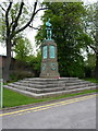
Residents of B67 6BF have access to a range of amenities within walking or short driving distance. Retail options include Asda Cape, Iceland Smethwick, and Farmfoods Smethwick, offering everyday shopping needs. The area’s rail stations, such as Smethwick Galton Bridge High Level and Hawthorns, provide connections to broader networks, while metro stops like Winson Green Outer Circle link to local hubs. Though the area is small, its proximity to Birmingham ensures access to larger leisure and cultural offerings. The historical legacy of Smethwick, including landmarks like the Smethwick Engine and Galton Bridge, adds a unique character to daily life. While parks and green spaces are not explicitly detailed in the data, the absence of planning constraints such as AONB or protected woodlands suggests room for local recreational activities. The combination of practical amenities and historical context creates a lived-in, community-oriented lifestyle.
Amenities
Schools
| Rank | School | Type | Entry gender | Ages |
|---|
Explore more schools in this area
Go to Schools tabDemographics
The community in B67 6BF is predominantly composed of adults aged 30–64, reflecting a mature, working-age population. The median age of 47 indicates a balance between younger and older residents, though fewer young families are evident. Home ownership stands at 48%, with houses being the primary accommodation type, suggesting a mix of owner-occupied properties and rentals. The predominant ethnic group is Asian, which shapes the area’s cultural and social dynamics. While specific deprivation data is not provided, the ownership rate and age profile suggest a population that is largely established and economically stable. This demographic profile implies a community focused on long-term residency, with residents likely prioritising practical living over transient lifestyles. The absence of detailed diversity metrics means the area’s social fabric remains partially opaque, but the presence of Asian communities highlights a distinct cultural influence.
Household Size
Accommodation Type
Tenure
Ethnic Group
Religion
Household Composition
Age
Household Deprivation
NS-SEC
Explore more demographic insights in this area
Go to Demographics tabPlanning
Planning Constraints
- Flood RiskPremium
- Ramsar Wetland SitesPremium
- Area of Outstanding Natural BeautyPremium
- Protected Nature ReservePremium
- Protected WoodlandPremium