Area Overview for B66 1RW
Photos of B66 1RW
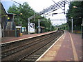
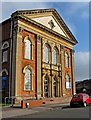
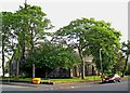
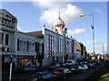
100 photos from this area
Area Information
Key information about the B66 1RW including its size, population, and administrative classification.
- Area Type
- Postcode
- Area Size
- 7105 m²
- Population
- 2943
- Population Density
- 4632 people/km²
House Prices in B66 1RW
20
Properties
£148,183
Average Sold Price
£79,950
Lowest Price
£315,000
Highest Price
Showing 20 properties
| Address | Type | Beds | Baths | Last Sale Price | Last Sale Date | |
|---|---|---|---|---|---|---|
| 4 Gibson Drive, Smethwick, B66 1RW | house | 3 | 1 | £315,000 | Dec 2023 | |
| 23 Gibson Drive, Smethwick, B66 1RW | Terraced | 2 | 1 | £133,000 | Jan 2020 | |
| 12 Gibson Drive, Smethwick, B66 1RW | Semi-detached | 6 | 2 | £232,500 | Nov 2019 | |
| 2 Gibson Drive, Smethwick, B66 1RW | Detached | 7 | 2 | £220,000 | Mar 2016 | |
| 19 Gibson Drive, Smethwick, B66 1RW | house | - | - | £149,000 | Oct 2007 | |
| 21 Gibson Drive, Smethwick, B66 1RW | Terraced | - | - | £123,000 | Apr 2007 | |
| 14 Gibson Drive, Smethwick, B66 1RW | Terraced | 3 | 1 | £149,950 | Mar 2007 | |
| 5 Gibson Drive, Smethwick, B66 1RW | Semi-detached | 3 | - | £172,500 | Jan 2007 | |
| 17 Gibson Drive, Smethwick, B66 1RW | house | - | - | £115,000 | Jan 2007 | |
| 11 Gibson Drive, Smethwick, B66 1RW | Semi-detached | 7 | 2 | £245,000 | Mar 2006 |
Page 1 of 2
Energy Efficiency in B66 1RW
Amenities
Schools
| Rank | School | Type | Entry gender | Ages |
|---|
Explore more schools in this area
Go to Schools tabDemographics
Household Size
Family (3-5 people)
most common
Accommodation Type
Houses
most common
Tenure
44
majority
Ethnic Group
asian_total
most common
Religion
N/A
most common
Household Composition
N/A
most common
Age
22
median
Adults (30-64 years)
most common
Household Deprivation
N/A
with no deprivation
NS-SEC
18
in Lower managerial occupations
Explore more demographic insights in this area
Go to Demographics tabPlanning
Planning Constraints
- Flood RiskPremium
- Ramsar Wetland SitesPremium
- Area of Outstanding Natural BeautyPremium
- Protected Nature ReservePremium
- Protected WoodlandPremium