Area Overview for B65 9QF
Photos of B65 9QF
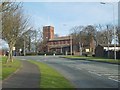
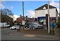
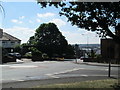
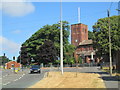
12 photos from this area
Area Information
Key information about the B65 9QF including its size, population, and administrative classification.
- Area Type
- Postcode
- Area Size
- 1.1 hectares
- Population
- 1556
- Population Density
- 6885 people/km²
House Prices in B65 9QF
28
Properties
£113,072
Average Sold Price
£56,500
Lowest Price
£220,000
Highest Price
Showing 28 properties
| Address | Type | Beds | Baths | Last Sale Price | Last Sale Date | |
|---|---|---|---|---|---|---|
| 58 Mincing Lane, Rowley Regis, B65 9QF | Terraced | 2 | 1 | £170,000 | Aug 2023 | |
| 34 Mincing Lane, Rowley Regis, B65 9QF | Bungalow | 2 | 1 | £220,000 | Apr 2023 | |
| 35 Mincing Lane, Rowley Regis, B65 9QF | Detached | 3 | 1 | £120,000 | Nov 2017 | |
| 38 Mincing Lane, Rowley Regis, B65 9QF | Semi-detached | 3 | 1 | £135,000 | Mar 2017 | |
| 44A Mincing Lane, Rowley Regis, B65 9QF | Detached | 3 | 1 | £152,000 | Jun 2016 | |
| 56 Mincing Lane, Rowley Regis, B65 9QF | Terraced | 2 | - | £105,000 | Jul 2015 | |
| 57 Mincing Lane, Rowley Regis, B65 9QF | Terraced | 3 | 1 | £70,000 | Jun 2010 | |
| 37 Mincing Lane, Rowley Regis, B65 9QF | Semi-detached | - | - | £120,000 | Nov 2007 | |
| 48 Mincing Lane, Rowley Regis, B65 9QF | Semi-detached | 3 | 1 | £131,250 | Sep 2007 | |
| 39 Mincing Lane, Rowley Regis, B65 9QF | Bungalow | - | - | £105,000 | Sep 2005 |
Page 1 of 3
Energy Efficiency in B65 9QF
Amenities
Schools
| Rank | School | Type | Entry gender | Ages |
|---|
Explore more schools in this area
Go to Schools tabDemographics
Household Size
Family (3-5 people)
most common
Accommodation Type
Houses
most common
Tenure
57
majority
Ethnic Group
White
most common
Religion
N/A
most common
Household Composition
N/A
most common
Age
47
median
Adults (30-64 years)
most common
Household Deprivation
N/A
with no deprivation
NS-SEC
19
in Lower managerial occupations
Explore more demographic insights in this area
Go to Demographics tabPlanning
Planning Constraints
- Flood RiskPremium
- Ramsar Wetland SitesPremium
- Area of Outstanding Natural BeautyPremium
- Protected Nature ReservePremium
- Protected WoodlandPremium