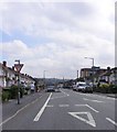
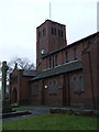
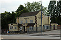
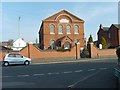
Area Overview for B65 9LP
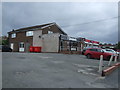
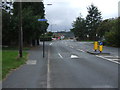
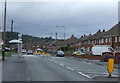
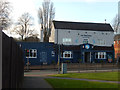
Photos of B65 9LP
Area Information
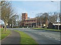
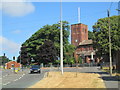
You are looking at a defined residential cluster within the broader Rowley Regis area, specifically the B65 9LP postcode. This small area covers 1,321 square metres and houses a population of 1,744 people. The location sits in Sandwell Metropolitan Borough Council, positioned west of Birmingham near the historic villages of Blackheath, Old Hill, and Cradley Heath. Historically, the region traces back to the Old English word *rūhlēah*, meaning 'rough wood or clearing,' with Roman evidence found locally and a Saxon religious site predating the first stone church built between 1199 and 1216. The name eventually incorporated 'Regis' when the land became part of royal hunting grounds around 1140. Today, the ward transitioned from an urban district in 1894 to a borough in 1933, merging into Warley in 1966 and finally into Sandwell in 1974. Living in B65 9LP means residing in a space defined by this deep history while benefiting from modern infrastructure. You benefit from a quiet setting away from the highest density urban centres, yet remain close to significant transport links and retail hubs like Tesco Rowley and Lidl Blackheath. The area offers a slice of locality that balances historical depth with functional modern living.
- Area Type
- Postcode
- Area Size
- 1321 m²
- Population
- Not available
- Population Density
- Not available
The property market in B65 9LP is characterised by a specific ownership dynamic that distinguishes it from newer development zones. Houses constitute the main type of accommodation in this small residential cluster, creating a landscape dominated by detached or semi-detached properties. With only 41% home ownership, the majority of residents in this postcode live in rented accommodation. This suggests a vibrant letting market where households move with slightly more frequency than in areas where the occupancy rate exceeds 70%. You are looking at an area where the character is preserved through traditional housing rather than large-scale urban regeneration projects. The postal code B65 9LP represents a pocket of the larger Rowley Regis town, meaning property values and trends will heavily influence decisions in the immediate wider area. Buyers should approach the market knowing that a significant portion of the stock is available for rent to those who cannot secure a mortgage. The mix of older housing stock, such as those built near the current St Giles church completed in 1923, offers value for those seeking the Rowley Regis lifestyle without the premium of the immediate city centre.
House Prices in B65 9LP
Showing 5 properties
| Address | Type | Beds | Baths | Last Sale Price | Last Sale Date | |
|---|---|---|---|---|---|---|
| 9 Bell End, Rowley Regis, B65 9LP | Semi-detached | 3 | 1 | £157,000 | Feb 2015 | |
| 1 Bell End, Rowley Regis, B65 9LP | Terraced | 3 | 2 | £105,000 | May 2014 | |
| 3 Bell End, Rowley Regis, B65 9LP | Terraced | 2 | 2 | £120,000 | Apr 2009 | |
| 5 Bell End, Rowley Regis, B65 9LP | Terraced | - | - | £79,950 | Mar 2002 | |
| 7 Bell End, Rowley Regis, B65 9LP | Terraced | - | - | £79,950 | Mar 2002 |
Energy Efficiency in B65 9LP
Your daily life in B65 9LP revolves around a cluster of amenities that are within practical reach without requiring a significant commute for basic needs. Retail options are plentiful, with five major stores located nearby. Supermarkets such as Tesco Rowley, Heron Blackheath, and Lidl Blackheath form the backbone of local shopping, ensuring you can buy groceries and household essentials quickly. For travel, five regional rail stations are conveniently located, including Rowley Regis Railway Station, Old Hill Railway Station, and Langley Green Railway Station. These stations provide the backbone for commuting to Birmingham and beyond. In addition to trains, five metro bus routes serve the area, operating from key points like Trinity Way, Dartmouth Street, and Lodge Road. This diversity in transport ensures that you are never cut off from the wider West Midlands network. The area retains a quiet character, yet it is not devoid of convenience. You can walk to essential services or catch a bus immediately. The proximity of these facilities means you do not need to venture far for daily errands, supporting a lifestyle that balances independence with community access.
Amenities
Schools
| Rank | School | Type | Entry gender | Ages |
|---|
Explore more schools in this area
Go to Schools tabDemographics
The community in B65 9LP reflects a mature demographic profile, which is evident in the area's age distribution. The median age stands at 47 years, confirming that Adults aged 30 to 64 years represent the most common age range. You should expect neighbours who are past their peak earning years but not yet retired. This population structure suggests a community focused on stability and long-term settlement rather than transient living. Data indicates that 41% of residents own their homes, meaning the majority of the population tend towards renting or shared ownership. This is notable given that Houses serve as the predominant form of accommodation, suggesting a traditional architectural stock rather than modern flats or high-rise units. The predominant ethnic group is White, which aligns with the broader demographic trends of the West Midlands. While specific data on deprivation is not provided, the combination of a high median age and significant home ownership indicates an established resident base. You are entering a neighbourhood where the primary householders have likely lived there for decades, creating a stable social fabric that resists rapid change.
Household Size
Accommodation Type
Tenure
Ethnic Group
Religion
Household Composition
Age
Household Deprivation
NS-SEC
Explore more demographic insights in this area
Go to Demographics tabPlanning
Planning Constraints
- Flood RiskPremium
- Ramsar Wetland SitesPremium
- Area of Outstanding Natural BeautyPremium
- Protected Nature ReservePremium
- Protected WoodlandPremium