Area Overview for B65 9AS
Photos of B65 9AS
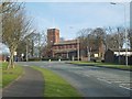
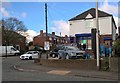
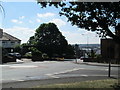
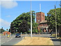
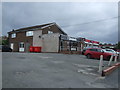
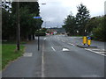
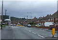
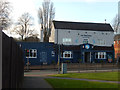
12 photos from this area
Area Information
Key information about the B65 9AS including its size, population, and administrative classification.
- Area Type
- Postcode
- Area Size
- 6974 m²
- Population
- 1424
- Population Density
- 3042 people/km²
House Prices in B65 9AS
24
Properties
£146,050
Average Sold Price
£59,000
Lowest Price
£310,000
Highest Price
Showing 24 properties
| Address | Type | Beds | Baths | Last Sale Price | Last Sale Date | |
|---|---|---|---|---|---|---|
| 32 Rowley Village, Rowley Regis, B65 9AS | Semi-detached | 3 | - | £180,000 | Sep 2021 | |
| 46 Rowley Village, Rowley Regis, B65 9AS | house | - | - | £145,000 | Jul 2021 | |
| 31 Rowley Village, Rowley Regis, B65 9AS | Semi-detached | 2 | 1 | £115,000 | Jun 2020 | |
| 45 Rowley Village, Rowley Regis, B65 9AS | Terraced | 3 | 1 | £115,000 | Sep 2019 | |
| 44 Rowley Village, Rowley Regis, B65 9AS | Terraced | 3 | 1 | £117,500 | Apr 2019 | |
| 30A Rowley Village, Rowley Regis, B65 9AS | Detached | 4 | 3 | £310,000 | Apr 2018 | |
| 29 Rowley Village, Rowley Regis, B65 9AS | Semi-detached | 3 | 1 | £167,000 | Jun 2017 | |
| 36 Rowley Village, Rowley Regis, B65 9AS | Terraced | 2 | 1 | £190,000 | Oct 2005 | |
| 30 Rowley Village, Rowley Regis, B65 9AS | Semi-detached | 3 | 1 | £59,000 | Jul 2002 | |
| 33 Rowley Village, Rowley Regis, B65 9AS | Semi-detached | - | - | £62,000 | Aug 2001 |
Page 1 of 3
Energy Efficiency in B65 9AS
Amenities
Schools
| Rank | School | Type | Entry gender | Ages |
|---|
Explore more schools in this area
Go to Schools tabDemographics
Household Size
Two person
most common
Accommodation Type
Houses
most common
Tenure
70
majority
Ethnic Group
White
most common
Religion
N/A
most common
Household Composition
N/A
most common
Age
47
median
Adults (30-64 years)
most common
Household Deprivation
N/A
with no deprivation
NS-SEC
26
in Lower managerial occupations
Explore more demographic insights in this area
Go to Demographics tabPlanning
Planning Constraints
- Flood RiskPremium
- Ramsar Wetland SitesPremium
- Area of Outstanding Natural BeautyPremium
- Protected Nature ReservePremium
- Protected WoodlandPremium