Area Overview for B64 7BW
Photos of B64 7BW
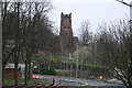
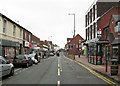
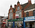
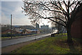
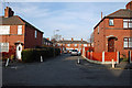
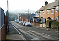
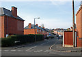
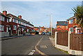
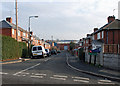
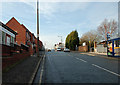
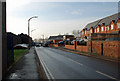
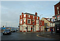
Area Information
The postcode B64 7BW sits within the Cradley Heath and Old Hill Ward in the Sandwell metropolitan borough. This small residential cluster spans just 2,763 square metres and is home to 1,851 people. Located approximately 8 miles west of Birmingham city centre, the area retains the industrial heritage of the Black Country while functioning as a modern suburban settlement. Originally part of the Staffordshire parish of Rowley Regis, the ward evolved from heathland into a community defined by the chain-making industry, a history most notable for the 1910 strike led by Mary MacArthur. Today, the area feels like a compact community where residents live among one another in a tight-knit environment. The specific coordinates near 52°27'N place it firmly within the urban sprawl of the West Midlands. Whether you are viewing homes in B64 7BW or exploring the broader surroundings, you are stepping into a place with deep historical roots in nail-making and chain-production. The current layout balances residential quiet with the legacy of a once-dominant manufacturing sector, offering a setting that reflects the durability of the region's past.
- Area Type
- Postcode
- Area Size
- 2763 m²
- Population
- 1851
- Population Density
- 2465 people/km²
The property market in B64 7BW is characterised by a dominance of houses and a strong preference for ownership. With 63% of residents being homeowners, the area is distinctly owner-occupied rather than a rental estate. The stock consists primarily of houses, which aligns with the area's development as a residential suburb rather than urban regeneration housing. This means you will find semi-detached and detached properties on streets designed for living rather than high-density sleeping. Buyers looking for homes in B64 7BW should expect traditional architecture rather than modern block dwellings. The low population density compared to the total area size allows for private gardens and mature gardens around these houses. The lack of flat options limits the market to those seeking standalone dwellings. For investors or first-time buyers, understanding that this is an owner-led market is essential. The housing stock reflects the economic history of the chain-making industry, where workers' housing often took the form of rows of houses rather than lodging houses.
House Prices in B64 7BW
No properties found in this postcode.
Energy Efficiency in B64 7BW
Daily life in B64 7BW benefits from a compact range of amenities within practical reach. Retail options include Iceland Cradley, Lidl Cradley, and Tesco Cradley, alongside four other shops. This ensures regular grocery shopping and household necessities are a short drive away. Commuting relies on a robust rail network with five stations nearby. Cradley Heath Railway Station, Old Hill Railway Station, and Lye Railway Station serve as the main points for getting to Birmingham or the rest of the West Midlands. Metro connectivity is supported by Bus stops at Dartmouth Street, Lodge Road, and West Bromwich Central. These rail and metro nodes make travelling to the city centre a routine task. The area also grants access to Haden Hill Park and Haden Old Hall, remnants of the area's historical landscape. The presence of these parks offers space for walking and recreation. Residents can combine the convenience of supermarkets near the main road accesses with the charm of local parklands.
Amenities
Schools
Families relying on schools near B64 7BW have two main options directly serving the local cluster. Timbertree Primary School operates as a primary school within the immediate vicinity, catering to younger students. Timbertree Academy functions as an academy, providing secondary and special educational needs provision for the older children. This combination means you do not need to look far beyond the postcode boundary for education. The presence of an academy alongside a primary school indicates a functional educational track nearby. Parents moving to this area can choose between the traditional primary route and the academy system. Both institutions are named specifically to avoid confusion with similarly named schools elsewhere in the region. The concentration of these two schools within the small area ensures that most children can attend without long travel times. You will find other schools in the wider Sandwell borough, but these two are the primary references for the B64 7BW cluster.
| Rank | School | Type | Entry gender | Ages |
|---|
Explore more schools in this area
Go to Schools tabDemographics
The community in B64 7BW skews mature, with a median age of 47 years. Adults aged between 30 and 64 years represent the most common age range. This demographic profile suggests a neighbourhood populated by families with children or couples approaching retirement rather than a hub for young professionals. Home ownership stands at 63%, indicating that the majority of residents own their properties outright or have a substantial mortgage. This ownership structure contrasts with the high-rental zones often found closer to city centres. Almost all accommodation takes the form of houses, creating a streetscape without high-rise apartments or purpose-built flats common in new developments. The predominant ethnic group is White, reflecting the broader composition of the Sandwell borough. You will find a settled population where long-term residents are the norm. The high proportion of householders buying physical homes rather than renting for a meal suggests stability within the cluster.
Household Size
Accommodation Type
Tenure
Ethnic Group
Religion
Household Composition
Age
Household Deprivation
NS-SEC
Explore more demographic insights in this area
Go to Demographics tabPlanning
Planning Constraints
- Flood RiskPremium
- Ramsar Wetland SitesPremium
- Area of Outstanding Natural BeautyPremium
- Protected Nature ReservePremium
- Protected WoodlandPremium