Area Overview for B64 6AQ
Photos of B64 6AQ
Area Information
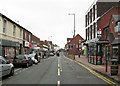
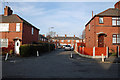
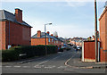
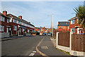
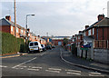
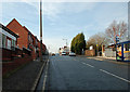
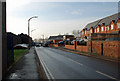
Cradley Heath and Old Hill form a distinct residential cluster approximately eight miles west of Birmingham city centre. This specific postcode area covers 385 m² and serves a population of 2,094 residents. The ward sits within the Sandwell Metropolitan Borough, acting as a bridge between the historic chains of the Black Country and the expanding suburbs of Rowley Regis. You will find yourself living in an area rooted in deep industrial history, where the land was once heathland settled by squatters before evolving into a hub for chain manufacturing. Daily life here is defined by proximity to the M6 motorway and a mixture of urban residential qualities. The area encompasses specific locations that define its layout, including Lomey Town, Newtown, and Mushroom Green. While the footprint is small, the setting is substantial, blending historical landmarks like Haden Hall with functional urban housing. You are situated near coordinates 52.463394, -2.064703, marking a clear boundary between Rowley Regis and the wider West Midlands. This location allows you to access the heart of the Black Country while remaining within commuting distance of major urban centres.
- Area Type
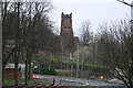
- Postcode
- Area Size
- 385 m²
- Population
- 2094
- Population Density
- 2573 people/km²
Housing in this postcode is primarily composed of houses, which indicates a stock suitable for families or those seeking space rather than flats or apartments. With 46% of the population owning their homes, you are looking at an area where long-term residents are well established. This higher rate of homeownership often suggests stability and a community where properties are passed down or held over many years. The residential cluster is small, covering just 385 m², which means the housing market is localised and any available homes move quickly. You are buying into an area that was historically significant for its chain-making industry, visible in the form of large pieces of industrial heritage. The presence of listed buildings, such as Corngreaves Hall and the Church of the Holy Trinity, shows that development is managed with an eye towards the past. Because the accommodation type is strictly houses, the market caters to buyers who desire gardens and private entrances rather than communal living spaces. You should expect a quiet, residential atmosphere away from the noise of heavy industry, yet close enough to the transport links to benefit from modern trade.
House Prices in B64 6AQ
No properties found in this postcode.
Energy Efficiency in B64 6AQ
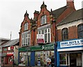
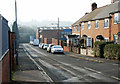
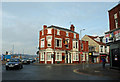
Your daily lifestyle revolves around a small cluster of local amenities that serve the 2,094 residents of this ward. You have five notable retail outlets nearby, providing essential shopping needs. You can visit Iceland Cradley, Lidl Cradley, and Tesco Cradley for groceries, alongside two other stores. These shops are sufficient for your weekly needs without requiring a trip to a larger town centre. For employment opportunities, the area is close to a range of business parks and office locations. You have access to five nearby railway stations and five metro stops, making commuting straightforward. The landmarks in your area include Haden Hill Park, which offers green space for recreation. Historic sites like Haden Hall and Haden Old Hall provide cultural interest and walking routes. You will find practical conveniences within walking distance, from the retail parks to the train stations. This mix of modern commerce and historical landmarks gives the area a grounded, accessible character.
Amenities
Schools
Families living in B64 6AQ have access to early years education close to home. The nearest specific provision is Cradley Heath Nursery School, listed as a nursery in the area. This facility supports parents with young children before they progress to primary education elsewhere in the Sandwell or Wolverhampton boroughs. With only one specific school named in the immediate vicinity, you should look beyond this single option if you need primary or secondary placements for older children. The concentration of just one nursery suggests that early childhood education is a focal point for the local community services. You will need to explore schools near B64 6AQ outside of this immediate data set to find primary and secondary options for older pupils. The presence of Cradley Heath Nursery School aligns with the demographic reality where adults aged 30-64 are the most common residents, many of whom will be school-age parents. While this specific dataset only details the nursery, it confirms that the area considers family needs in its planning.
| Rank | School | Type | Entry gender | Ages |
|---|
Explore more schools in this area
Go to Schools tabDemographics
The community in B64 6AQ is characterised by a mature demographic profile. You will find that the residents skew towards middle age, with a median age of 47 years. Adults between 30 and 64 years represent the most common age range in this neighbourhood. This indicates a stable population focused on family life or established careers. Homeownership is a major feature of the area, with 46% of households owning their property outright or with a mortgage. The accommodation type is dominated by houses, reflecting the suburban nature of this ward. The predominant ethnic group remains White, aligning with the broader cultural context of the West Midlands. Because the area is older and was historically driven by an industrial economy, many long-standing families have settled here across generations. The population density is remarkably high at 5,445,442 people per km², though this figure reflects the specific small geographical area covered by the postcode compared to the wider local authority. This density often means you live in a tight-knit environment where neighbours know one another well.
Household Size
Accommodation Type
Tenure
Ethnic Group
Religion
Household Composition
Age
Household Deprivation
NS-SEC
Explore more demographic insights in this area
Go to Demographics tabPlanning
Planning Constraints
- Flood RiskPremium
- Ramsar Wetland SitesPremium
- Area of Outstanding Natural BeautyPremium
- Protected Nature ReservePremium
- Protected WoodlandPremium