Area Overview for B64 6AF
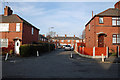
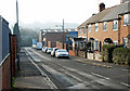
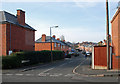
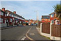
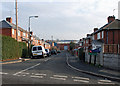
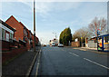
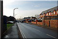
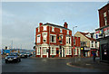
Photos of B64 6AF
Area Information
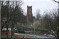
B64 6AF is a small residential postcode area in the Black Country, nestled in Sandwell, West Midlands, approximately 8 miles west of Birmingham city centre. It forms part of the Cradley Heath and Old Hill Ward, an area with deep historical roots in heathland and industrial heritage. The community, with a population of 2094, reflects a mature demographic, shaped by its past as a hub for chain-making and the 1910 strike led by Mary MacArthur. Today, the area blends historic listed buildings like Corngreaves Hall with modern enterprise zones. Daily life is defined by proximity to rail and metro networks, retail outlets, and green spaces such as Haden Hill Park. While the area lacks large-scale commercial employers, its strategic location near Birmingham offers commuters access to the city’s economic opportunities. The compact nature of B64 6AF means residents are close to essential services, though the small population suggests a tight-knit, community-focused environment.
- Area Type
- Postcode
- Area Size
- Not available
- Population
- 2094
- Population Density
- 2573 people/km²
The property market in B64 6AF is defined by a 46% home ownership rate, meaning nearly half of properties are owner-occupied, while the remaining 54% are likely rented. The area is predominantly composed of houses, with few flats or apartments, indicating a traditional, family-oriented housing stock. This mix of owner-occupied and rental properties suggests a dynamic market, though the small population and compact size of the postcode mean the area is not a major hub for property speculation. Buyers should consider the limited number of homes available, as the area’s size restricts expansion. The presence of houses may appeal to those seeking larger living spaces, though proximity to Birmingham’s infrastructure could make it a strategic choice for commuters. However, the lack of large-scale development or new builds may limit future growth in the housing market.
House Prices in B64 6AF
No properties found in this postcode.
Energy Efficiency in B64 6AF
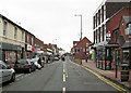
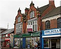
The lifestyle in B64 6AF is shaped by its proximity to retail, transport, and green spaces. Within walking distance are five retail outlets, including Lidl Cradley, Iceland Cradley, and Tesco Cradley, offering everyday shopping convenience. The area’s rail and metro stations—Cradley Heath, Old Hill, Lye, Dartmouth Street, Lodge Road, and West Bromwich Central—provide frequent connections to Birmingham and beyond. While the data does not mention parks or leisure facilities directly, historical research highlights Haden Hill Park, a nearby green space with listed buildings like Haden Hall. This blend of retail, transport, and accessible nature suggests a balanced lifestyle, though residents may need to venture slightly further for more extensive leisure options. The compact size of the area ensures that essentials are within reach, fostering a practical, community-oriented way of life.
Amenities
Schools
The nearest school to B64 6AF is Cradley Heath Nursery School, which provides early years education. No primary or secondary schools are listed in the data, meaning families may need to look beyond the immediate area for comprehensive schooling. The absence of higher education institutions or larger schools suggests that parents should investigate nearby wards for secondary education options. The single nursery school indicates a focus on early childhood development, but the lack of detailed Ofsted ratings or curriculum information means prospective residents must conduct further research into local educational provision. This could be a consideration for families prioritising a range of school types within walking or short commuting distance.
| Rank | School | Type | Entry gender | Ages |
|---|
Explore more schools in this area
Go to Schools tabDemographics
The population of B64 6AF is predominantly adults aged 30–64, with a median age of 47, indicating a mature community. Home ownership rates stand at 46%, suggesting a mix of owner-occupied and rental properties. The area is characterised by houses rather than flats, reflecting a traditional housing stock. The predominant ethnic group is White, though specific data on diversity or deprivation is not provided. This demographic profile implies a stable, long-term resident base, with families and professionals likely to be the primary occupants. The absence of detailed diversity statistics means the community’s composition remains less defined in terms of cultural or socioeconomic variation. The age range suggests a balance between working-age adults and retirees, potentially influencing local services and amenities.
Household Size
Accommodation Type
Tenure
Ethnic Group
Religion
Household Composition
Age
Household Deprivation
NS-SEC
Explore more demographic insights in this area
Go to Demographics tabPlanning
Planning Constraints
- Flood RiskPremium
- Ramsar Wetland SitesPremium
- Area of Outstanding Natural BeautyPremium
- Protected Nature ReservePremium
- Protected WoodlandPremium