Area Overview for B64 5AW
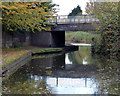
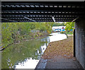
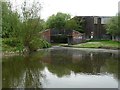
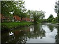
Photos of B64 5AW
Area Information
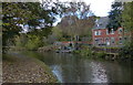
Living in B64 5AW means residing within a specific residential cluster covering 1.9 hectares near Rowley Regis. This small postcode area forms part of the wider Rowley Ward, which historically included villages like Blackheath, Old Hill, and Cradley Heath. The location sits west of Birmingham within the Sandwell Metropolitan Borough Council area. Population figures show 1,875 residents living in this compact space, creating a population density of 99,773 people per square kilometre. You will be hours away from the ancient woodland camps hinted at by Pencricket Lane, yet you enjoy the stability of a community where St Giles Church has stood since the 12th century. The area transitioned from a parish to an urban district by 1894 and became a borough in 1933, giving it a deep local identity. Today, the setting offers a quiet environment where the modern administrative boundaries of Sandwell meet the history of a former municipal borough. While the immediate cluster is small, you are connected to the broader transport network that Defined the region for over a century. This makes B64 5AW suitable for those seeking a rooted community with access to extensive historical infrastructure without the density of larger urban centres.
- Area Type
- Postcode
- Area Size
- 1.9 hectares
- Population
- 1875
- Population Density
- 3466 people/km²
You will find that B64 5AW is defined by a stock of houses where 59 per cent of the population owns their homes. This high ownership rate points to an area where residents have invested their savings into the local property market. The accommodation type is almost exclusively houses, meaning you will not find the density of high-rise flats or terraced worker housing found in some industrial cores. Buying a home here offers the chance to secure a property in a cluster that prioritises garden space and residential privacy. The 1,875 residents across this small 1.9 hectare footprint suggest limited land availability, which supports sustained property values rather than speculative development. The local history of Rowley Regis, stretching back to the 11th century, adds a layer of permanence to the housing stock. When you evaluate homes in this postcode, you benefit from established housing that has survived municipal boundary changes from 1894 to 1974. The market is characterised by practical ownership rather than investment rentals. This stability means you join existing covenants and neighbourhood associations where plans are discussed and agreed upon by long-term residents.
House Prices in B64 5AW
No properties found in this postcode.
Energy Efficiency in B64 5AW
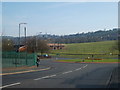
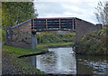
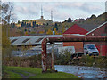
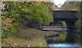
Your daily life in B64 5AW is supported by a practical network of amenities within practical reach. Supermarkets and retail options include Spar Rowley, Heron Old, and Lidl Netherton, ensuring you have access to essential groceries and daily necessities. For commuting, five railway stations serve the vicinity, with Old Hill, Rowley Regis, and Cradley Heath offering connections to the wider regional rail network. Metro services are also accessible, with stops at Dartmouth Street, Lodge Road, and West Bromwich Central providing additional flexibility for public transport. These five rail stations and five metro stops within your reach mean you have many choices for travelling to Birmingham or other business centres. The local history of St Giles Church and the presence of Rowley Regis Hospital managed by Sandwell and West Birmingham Hospitals NHS Trust add community facilities to this list. You can walk to Spar Rowley for quick errands or drive to Cradley Heath for larger shopping trips. The combination of historic landmarks and modern transport links creates a lifestyle that balances rural heritage with urban convenience.
Amenities
Schools
| Rank | School | Type | Entry gender | Ages |
|---|
Explore more schools in this area
Go to Schools tabDemographics
The community in B64 5AW is dominated by adults between 30 and 64 years old, with a median age of 47. This age profile suggests a stable household structure where many families are established or entering retirement stages. Home ownership is a defining feature, with 59 per cent of residents owning their properties. The remaining population likely comprises tenants or those approaching retirement who have chosen to downsize. Accommodation types are primarily houses, reflecting the suburban character inherited from its development as a municipal borough. The predominant ethnic group is White, which aligns with the traditional demographic patterns of the West Midlands industrial towns. You will find a neighbourhood where long-term residents have shaped the local culture over generations. The high proportion of home owners indicates financial stability and a strong attachment to the location. This demographic mix creates an environment where community engagement often relies on long-standing neighbourhood ties rather than the transient nature of student towns or worker housing estates. For those considering buying, the area offers a chance to join an established community where life rhythms are set by local family traditions rather than temporary urban pressures.
Household Size
Accommodation Type
Tenure
Ethnic Group
Religion
Household Composition
Age
Household Deprivation
NS-SEC
Explore more demographic insights in this area
Go to Demographics tabPlanning
Planning Constraints
- Flood RiskPremium
- Ramsar Wetland SitesPremium
- Area of Outstanding Natural BeautyPremium
- Protected Nature ReservePremium
- Protected WoodlandPremium