Area Overview for B64 5PT
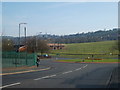
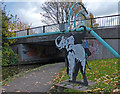
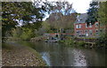
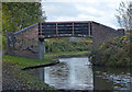
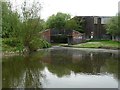
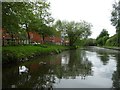
Photos of B64 5PT


Area Information
Living in B64 5PT means being part of a small, tightly knit residential cluster in the West Midlands, nestled within the historic town of Rowley Regis. With a population of 1,875, this area is defined by its compact size and proximity to both urban and rural elements. Rowley Regis itself has roots in medieval times, with its name deriving from Old English, and today it serves as a commuter hub for nearby Birmingham. The area’s character is shaped by its transition from a rural parish to an industrial district, with landmarks like St Giles Church and Rowley Regis Hospital anchoring its identity. Daily life here balances practicality with historical resonance, offering residents a quiet, stable environment. The postcode’s proximity to rail networks and retail amenities ensures convenience, while its modest size fosters a sense of community. For those seeking a place with a manageable population and accessible transport, B64 5PT provides a blend of tradition and modernity.
- Area Type
- Postcode
- Area Size
- Not available
- Population
- 1875
- Population Density
- 3466 people/km²
The property market in B64 5PT is characterised by a 59% home ownership rate, with houses forming the predominant accommodation type. This indicates a community where private ownership is common, though not universal, and where the housing stock is largely composed of single-family homes. Given the small size of the postcode area, the market is likely limited in scale but may extend into nearby suburbs such as Rowley Regis and Cradley Heath. The focus on houses suggests a preference for larger, more private living spaces, which could appeal to families or individuals seeking space. However, the limited data on property types or price ranges means buyers should consider adjacent areas for broader options. The modest population size also implies a relatively stable market, with fewer fluctuations compared to larger urban centres.
House Prices in B64 5PT
Showing 1 properties
| Address | Type | Beds | Baths | Last Sale Price | Last Sale Date | |
|---|---|---|---|---|---|---|
| Enablelink Limited, 99A Powke Lane, Cradley Heath, B64 5PT | Industrial | - | - | - | - |
Energy Efficiency in B64 5PT
Residents of B64 5PT have access to a range of nearby amenities within practical reach. Retail options include Spar Rowley, Heron Old, and Lidl Netherton, offering everyday essentials and convenience. The area’s rail network, with stations like Old Hill and Rowley Regis, connects to broader transport systems, while metro stops such as West Bromwich Central provide additional links. Though the data does not mention parks or leisure facilities, the presence of multiple retail and transport hubs suggests a functional, community-focused lifestyle. The area’s historical sites, such as St Giles Church, add cultural depth, while its proximity to industrial and urban zones ensures a balance between quiet living and accessibility. For those prioritising practicality and connectivity, B64 5PT provides a straightforward, well-served environment.
Amenities
Schools
| Rank | School | Type | Entry gender | Ages |
|---|
Explore more schools in this area
Go to Schools tabDemographics
The community in B64 5PT is predominantly composed of adults aged 30–64, with a median age of 47. This suggests a mature population, likely with established careers and families. Home ownership rates stand at 59%, indicating a mix of owner-occupied properties and rental units. The accommodation type is largely houses, reflecting a residential area with a focus on single-family homes rather than apartments or flats. The predominant ethnic group is White, aligning with broader trends in the West Midlands. While the data does not specify deprivation levels, the age profile and home ownership suggest a stable, middle-income demographic. The absence of detailed diversity metrics means the community’s full cultural composition remains less defined, but the presence of multiple railway stations and retail outlets hints at a functional, service-oriented population.
Household Size
Accommodation Type
Tenure
Ethnic Group
Religion
Household Composition
Age
Household Deprivation
NS-SEC
Explore more demographic insights in this area
Go to Demographics tabPlanning
Planning Constraints
- Flood RiskPremium
- Ramsar Wetland SitesPremium
- Area of Outstanding Natural BeautyPremium
- Protected Nature ReservePremium
- Protected WoodlandPremium