Area Overview for B63 4DE
Photos of B63 4DE
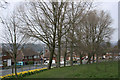
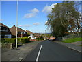
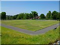
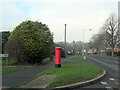
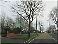
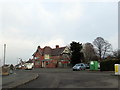
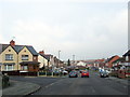
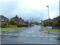
24 photos from this area
Area Information
Key information about the B63 4DE including its size, population, and administrative classification.
- Area Type
- Postcode
- Area Size
- 1.2 hectares
- Population
- 1532
- Population Density
- 5257 people/km²
House Prices in B63 4DE
43
Properties
£111,724
Average Sold Price
£47,500
Lowest Price
£175,000
Highest Price
Showing 43 properties
| Address | Type | Beds | Baths | Last Sale Price | Last Sale Date | |
|---|---|---|---|---|---|---|
| 33 George Road, Halesowen, B63 4DE | Terraced | 3 | 1 | £175,000 | Mar 2024 | |
| 18 George Road, Halesowen, B63 4DE | Terraced | 2 | 1 | £165,000 | Dec 2021 | |
| 32 George Road, Halesowen, B63 4DE | house | - | - | £160,000 | Dec 2020 | |
| 41 George Road, Halesowen, B63 4DE | Terraced | 3 | 1 | £125,000 | Jan 2020 | |
| 27 George Road, Halesowen, B63 4DE | house | - | - | £150,000 | Dec 2019 | |
| 22 George Road, Halesowen, B63 4DE | Terraced | 2 | 2 | £107,500 | Aug 2018 | |
| 30 George Road, Halesowen, B63 4DE | house | - | - | £125,000 | Apr 2018 | |
| 39 George Road, Halesowen, B63 4DE | house | - | - | £103,000 | Sep 2017 | |
| 45 George Road, Halesowen, B63 4DE | house | - | - | £49,132 | Sep 2014 | |
| 34 George Road, Halesowen, B63 4DE | Terraced | 2 | 1 | £110,000 | May 2008 |
Page 1 of 5
Energy Efficiency in B63 4DE
Amenities
Schools
| Rank | School | Type | Entry gender | Ages |
|---|
Explore more schools in this area
Go to Schools tabDemographics
Household Size
Two person
most common
Accommodation Type
Houses
most common
Tenure
67
majority
Ethnic Group
White
most common
Religion
N/A
most common
Household Composition
N/A
most common
Age
47
median
Adults (30-64 years)
most common
Household Deprivation
N/A
with no deprivation
NS-SEC
26
in Lower managerial occupations
Explore more demographic insights in this area
Go to Demographics tabPlanning
Planning Constraints
- Flood RiskPremium
- Ramsar Wetland SitesPremium
- Area of Outstanding Natural BeautyPremium
- Protected Nature ReservePremium
- Protected WoodlandPremium