Area Overview for B62 9NW
Photos of B62 9NW
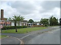
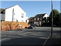
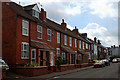
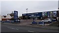
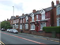
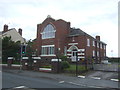
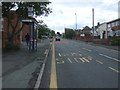
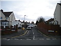
14 photos from this area
Area Information
Key information about the B62 9NW including its size, population, and administrative classification.
- Area Type
- Postcode
- Area Size
- 1.5 hectares
- Population
- 1546
- Population Density
- 6920 people/km²
House Prices in B62 9NW
43
Properties
£184,061
Average Sold Price
£55,500
Lowest Price
£375,000
Highest Price
Showing 43 properties
| Address | Type | Beds | Baths | Last Sale Price | Last Sale Date | |
|---|---|---|---|---|---|---|
| 57 Summerfields Avenue, Halesowen, B62 9NW | Semi-detached | 4 | 2 | £340,000 | Apr 2025 | |
| 44 Summerfields Avenue, Halesowen, B62 9NW | Semi-detached | 3 | 1 | £224,000 | Jul 2024 | |
| 42 Summerfields Avenue, Halesowen, B62 9NW | Semi-detached | 3 | 3 | £375,000 | Jul 2023 | |
| 24 Summerfields Avenue, Halesowen, B62 9NW | house | - | - | £305,000 | Dec 2022 | |
| 59 Summerfields Avenue, Halesowen, B62 9NW | Semi-detached | 3 | 1 | £266,350 | Nov 2022 | |
| 18 Summerfields Avenue, Halesowen, B62 9NW | house | - | - | £205,000 | Mar 2022 | |
| 41 Summerfields Avenue, Halesowen, B62 9NW | house | - | - | £247,000 | Jun 2021 | |
| 36 Summerfields Avenue, Halesowen, B62 9NW | Semi-detached | 3 | 1 | £225,000 | Oct 2019 | |
| 55 Summerfields Avenue, Halesowen, B62 9NW | house | 3 | - | £265,000 | Aug 2019 | |
| 25 Summerfields Avenue, Halesowen, B62 9NW | Semi-detached | 3 | 1 | £154,000 | Jun 2018 |
Page 1 of 5
Energy Efficiency in B62 9NW
Amenities
Schools
| Rank | School | Type | Entry gender | Ages |
|---|
Explore more schools in this area
Go to Schools tabDemographics
Household Size
One person
most common
Accommodation Type
Houses
most common
Tenure
68
majority
Ethnic Group
White
most common
Religion
N/A
most common
Household Composition
N/A
most common
Age
47
median
Adults (30-64 years)
most common
Household Deprivation
N/A
with no deprivation
NS-SEC
30
in Lower managerial occupations
Explore more demographic insights in this area
Go to Demographics tabPlanning
Planning Constraints
- Flood RiskPremium
- Ramsar Wetland SitesPremium
- Area of Outstanding Natural BeautyPremium
- Protected Nature ReservePremium
- Protected WoodlandPremium