Area Overview for B62 9NF
Photos of B62 9NF
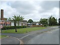
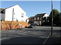
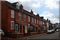
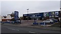
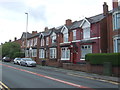
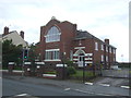
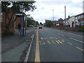
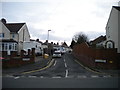
14 photos from this area
Area Information
Key information about the B62 9NF including its size, population, and administrative classification.
- Area Type
- Postcode
- Area Size
- 1.1 hectares
- Population
- 1373
- Population Density
- 3089 people/km²
House Prices in B62 9NF
34
Properties
£166,256
Average Sold Price
£46,000
Lowest Price
£270,000
Highest Price
Showing 34 properties
| Address | Type | Beds | Baths | Last Sale Price | Last Sale Date | |
|---|---|---|---|---|---|---|
| 63 Westbourne Road, Halesowen, B62 9NF | Semi-detached | 3 | 1 | £250,000 | Aug 2024 | |
| 44 Westbourne Road, Halesowen, B62 9NF | Semi-detached | 3 | 1 | £260,000 | Nov 2023 | |
| 53 Westbourne Road, Halesowen, B62 9NF | Semi-detached | 3 | - | £270,000 | May 2022 | |
| 41 Westbourne Road, Halesowen, B62 9NF | Retail | 3 | 1 | £207,500 | Apr 2022 | |
| 69 Westbourne Road, Halesowen, B62 9NF | house | 3 | - | £230,000 | Aug 2021 | |
| 43 Westbourne Road, Halesowen, B62 9NF | house | - | - | £190,000 | Mar 2021 | |
| 59 Westbourne Road, Halesowen, B62 9NF | Semi-detached | 3 | 1 | £195,000 | Sep 2019 | |
| 50 Westbourne Road, Halesowen, B62 9NF | Semi-detached | 3 | 1 | £205,000 | Jun 2019 | |
| 55 Westbourne Road, Halesowen, B62 9NF | Semi-detached | 3 | 2 | £265,000 | Jun 2019 | |
| 39 Westbourne Road, Halesowen, B62 9NF | Semi-detached | 3 | 1 | £205,000 | Oct 2018 |
Page 1 of 4
Energy Efficiency in B62 9NF
Amenities
Schools
| Rank | School | Type | Entry gender | Ages |
|---|
Explore more schools in this area
Go to Schools tabDemographics
Household Size
One person
most common
Accommodation Type
Houses
most common
Tenure
69
majority
Ethnic Group
White
most common
Religion
N/A
most common
Household Composition
N/A
most common
Age
47
median
Adults (30-64 years)
most common
Household Deprivation
N/A
with no deprivation
NS-SEC
30
in Lower managerial occupations
Explore more demographic insights in this area
Go to Demographics tabPlanning
Planning Constraints
- Flood RiskPremium
- Ramsar Wetland SitesPremium
- Area of Outstanding Natural BeautyPremium
- Protected Nature ReservePremium
- Protected WoodlandPremium