Area Overview for B62 9AQ
Photos of B62 9AQ
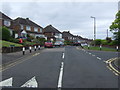

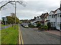
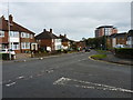
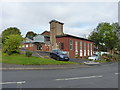
19 photos from this area
Area Information
Key information about the B62 9AQ including its size, population, and administrative classification.
- Area Type
- Postcode
- Area Size
- 3.3 hectares
- Population
- 1373
- Population Density
- 3089 people/km²
House Prices in B62 9AQ
35
Properties
£182,078
Average Sold Price
£60,000
Lowest Price
£350,000
Highest Price
Showing 35 properties
| Address | Type | Beds | Baths | Last Sale Price | Last Sale Date | |
|---|---|---|---|---|---|---|
| 153 Woodbury Road, Halesowen, B62 9AQ | Bungalow | 2 | 1 | £280,000 | Feb 2025 | |
| 149 Woodbury Road, Halesowen, B62 9AQ | Bungalow | 2 | 1 | £350,000 | Dec 2024 | |
| 98 Woodbury Road, Halesowen, B62 9AQ | Bungalow | 2 | 1 | £290,000 | Jun 2023 | |
| 118 Woodbury Road, Halesowen, B62 9AQ | Bungalow | 2 | 1 | £235,000 | Jan 2021 | |
| 171 Woodbury Road, Halesowen, B62 9AQ | house | - | - | £150,000 | Oct 2019 | |
| 151 Woodbury Road, Halesowen, B62 9AQ | Bungalow | - | - | £175,000 | Sep 2018 | |
| 124 Woodbury Road, Halesowen, B62 9AQ | Bungalow | - | - | £220,000 | Jan 2018 | |
| 155 Woodbury Road, Halesowen, B62 9AQ | house | - | - | £185,000 | Nov 2017 | |
| 116 Woodbury Road, Halesowen, B62 9AQ | house | - | - | £215,000 | Sep 2017 | |
| 94 Woodbury Road, Halesowen, B62 9AQ | Bungalow | 2 | - | £240,000 | Mar 2017 |
Page 1 of 4
Energy Efficiency in B62 9AQ
Amenities
Schools
| Rank | School | Type | Entry gender | Ages |
|---|
Explore more schools in this area
Go to Schools tabDemographics
Household Size
One person
most common
Accommodation Type
Houses
most common
Tenure
69
majority
Ethnic Group
White
most common
Religion
N/A
most common
Household Composition
N/A
most common
Age
47
median
Adults (30-64 years)
most common
Household Deprivation
N/A
with no deprivation
NS-SEC
30
in Lower managerial occupations
Explore more demographic insights in this area
Go to Demographics tabPlanning
Planning Constraints
- Flood RiskPremium
- Ramsar Wetland SitesPremium
- Area of Outstanding Natural BeautyPremium
- Protected Nature ReservePremium
- Protected WoodlandPremium