Area Overview for B62 9BJ
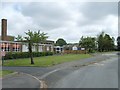
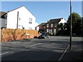
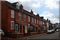
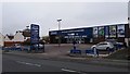
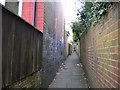
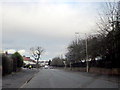
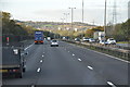
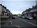
Photos of B62 9BJ
Area Information
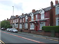
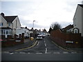
Living in B62 9BJ means being part of a small, tightly knit residential cluster in Halesowen, a historic market town in the West Midlands. With a population of 1,373, this area reflects a community rooted in tradition yet connected to modern amenities. Halesowen itself has a long history, recorded in the Domesday Book as larger than Birmingham, and its character is shaped by centuries of industrial heritage, including nail manufacturing and coal mining. Today, B62 9BJ sits within this legacy, offering a quiet, residential environment with easy access to nearby towns and cities. The area’s compact size means a strong sense of local identity, with residents likely to know their neighbours. Its proximity to rail networks and retail hubs like Asda Quinton and Farmfoods Halesowen ensures convenience without the hustle of a larger urban centre. For those valuing stability and a slower pace of life, B62 9BJ combines historical charm with practical modern living.
- Area Type
- Postcode
- Area Size
- Not available
- Population
- 1373
- Population Density
- 3089 people/km²
B62 9BJ is a predominantly owner-occupied area, with 69% of homes owned by residents rather than rented. The accommodation type is primarily houses, which is typical for smaller residential clusters where larger properties dominate. This suggests a market geared towards families or individuals seeking more space, though the area’s compact size may limit housing stock. Given the high home ownership rate, property values are likely to be stable, with fewer short-term rental pressures. Buyers should consider the area’s limited scale, as opportunities for new developments may be constrained by planning restrictions or local character preservation. The focus on houses also means that properties here may cater to specific needs, such as garden space or home offices, rather than high-density living.
House Prices in B62 9BJ
No properties found in this postcode.
Energy Efficiency in B62 9BJ
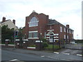
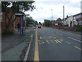
Residents of B62 9BJ have access to a range of amenities within practical reach. Retail options include Asda Quinton, Farmfoods Halesowen, and Co-op Brandhall, providing everyday shopping convenience. The area’s transport links extend beyond commuting, with rail and metro stations enabling quick access to leisure, dining, and cultural opportunities in nearby towns. Halesowen’s historical significance adds to its character, with landmarks such as Halesowen Abbey and the Parish Church of St John the Baptist offering a connection to the past. The town’s market heritage and industrial history are woven into its present-day fabric, creating a unique blend of heritage and modernity. For those seeking a balance between convenience and community, B62 9BJ offers both local amenities and easy access to broader regional networks.
Amenities
Schools
| Rank | School | Type | Entry gender | Ages |
|---|
Explore more schools in this area
Go to Schools tabDemographics
The population of B62 9BJ is 1,373, with a median age of 47, indicating a mature community. The most common age range is adults aged 30–64, suggesting a stable demographic with established households. Home ownership is high at 69%, reflecting a preference for long-term residency over rental properties. The predominant accommodation type is houses, aligning with the area’s residential character. The predominant ethnic group is White, though specific data on diversity or deprivation is not provided. This age profile implies a community focused on family life and local continuity, with fewer young families or retirees compared to other areas. The high home ownership rate also suggests economic stability, with residents likely to have invested in property over time.
Household Size
Accommodation Type
Tenure
Ethnic Group
Religion
Household Composition
Age
Household Deprivation
NS-SEC
Explore more demographic insights in this area
Go to Demographics tabPlanning
Planning Constraints
- Flood RiskPremium
- Ramsar Wetland SitesPremium
- Area of Outstanding Natural BeautyPremium
- Protected Nature ReservePremium
- Protected WoodlandPremium