Area Overview for B62 8DA
Photos of B62 8DA

Area Information
Living in B62 8DA means being part of a densely populated, small residential cluster in the heart of the Dudley Metropolitan Borough. With a population of 1,761 spread across just 2.0 hectares, this postcode area is highly compact, reflecting the suburban integration of Halesowen into the Black Country’s urban fabric. The area’s history as an exclave of Shropshire, transferred to Worcestershire in 1844, lingers in its character, though modern life here is defined by proximity to retail, transport, and local amenities. Residents benefit from excellent digital connectivity and access to rail networks, while the surrounding landscape includes historical sites like Halesowen Abbey ruins. Daily life here is shaped by a mature community, with a median age of 47 and a strong presence of families in owner-occupied homes. The area’s small size means it is tightly woven into the broader Halesowen and Dudley networks, offering a blend of suburban convenience and regional connectivity.
- Area Type
- Postcode
- Area Size
- 2.0 hectares
- Population
- 1761
- Population Density
- 2556 people/km²
B62 8DA is a predominantly owner-occupied area, with 81% of homes owned by residents rather than rented. The accommodation type is primarily houses, which is unusual for a small postcode area but may indicate a mix of semi-detached or terraced properties. Given the area’s compact size and high population density, the housing stock is likely limited to a small number of properties, making it a niche market for buyers seeking specific homes. The high home ownership rate suggests a stable market with fewer rental options, which could be advantageous for those prioritising long-term investment. However, the small area size means that buyers may need to consider nearby suburbs or larger postcode areas for more housing choices. The focus on houses rather than flats or apartments may appeal to families or those preferring traditional property types.
House Prices in B62 8DA
Showing 1 properties
| Address | Type | Beds | Baths | Last Sale Price | Last Sale Date | |
|---|---|---|---|---|---|---|
| Mucklow Office Park, Mucklow Hill, Halesowen, B62 8DA | Office | - | - | - | - |
Energy Efficiency in B62 8DA
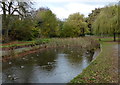
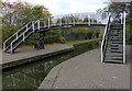
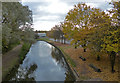
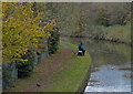
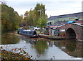
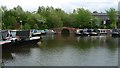
Daily life in B62 8DA is enriched by nearby amenities that cater to shopping, transport, and leisure. Retail options include Farmfoods Halesowen, Co-op Spies, and Makro Birmingham, providing access to groceries, household goods, and larger-scale retail. The area’s proximity to rail and metro stations—Rowley Regis, Old Hill, Cradley Heath, Kenrick Park, Trinity Way, and West Bromwich Central—ensures easy access to regional transport networks, facilitating both commuting and weekend travel. For leisure, the nearby Leasowes Park offers a public green space with 18th-century landscape features, ideal for walking or relaxation. The combination of retail, transport, and green spaces creates a balanced lifestyle, blending suburban convenience with opportunities for outdoor activity and regional connectivity.
Amenities
Schools
The nearest schools to B62 8DA include Leasowes High School, which operates as both a primary school and an academy with a ‘good’ Ofsted rating. This dual role means the school serves multiple age groups, offering convenience for families with children at different stages of education. The academy’s ‘good’ rating indicates a solid standard of education, though specific details on curriculum or performance are not provided. The presence of a primary school within the area ensures that younger children have access to local education without the need for long commutes. For older students, the academy provides a secondary-level option, reducing reliance on schools further afield. The mix of school types suggests a well-rounded educational environment, though prospective families should verify current Ofsted reports for the most up-to-date assessment.
| Rank | School | Type | Entry gender | Ages |
|---|
Explore more schools in this area
Go to Schools tabDemographics
The population of B62 8DA is 1,761, with a density of 88,633 people per square kilometre, making it one of the most densely populated areas in England. The median age is 47, with the majority of residents aged 30–64, reflecting a mature, established community. Home ownership is high at 81%, and the predominant accommodation type is houses, suggesting a mix of family homes and long-term residents. The predominant ethnic group is White, though specific data on diversity or deprivation is not provided. This demographic profile indicates a stable, largely middle-aged population with strong ties to property ownership. The high home ownership rate and age range suggest a community focused on long-term residency rather than transient living, which can influence local services and amenities.
Household Size
Accommodation Type
Tenure
Ethnic Group
Religion
Household Composition
Age
Household Deprivation
NS-SEC
Explore more demographic insights in this area
Go to Demographics tabPlanning
Planning Constraints
- Flood RiskPremium
- Ramsar Wetland SitesPremium
- Area of Outstanding Natural BeautyPremium
- Protected Nature ReservePremium
- Protected WoodlandPremium