Area Overview for B62 0HT
Photos of B62 0HT

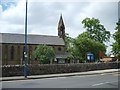


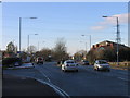
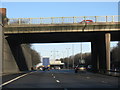
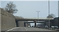

39 photos from this area
Area Information
Key information about the B62 0HT including its size, population, and administrative classification.
- Area Type
- Postcode
- Area Size
- 9284 m²
- Population
- 1755
- Population Density
- 3511 people/km²
House Prices in B62 0HT
21
Properties
£193,250
Average Sold Price
£143,000
Lowest Price
£254,000
Highest Price
Showing 21 properties
| Address | Type | Beds | Baths | Last Sale Price | Last Sale Date | |
|---|---|---|---|---|---|---|
| 137 Howley Grange Road, Halesowen, B62 0HT | house | - | - | £212,500 | Jul 2024 | |
| 100 Howley Grange Road, Halesowen, B62 0HT | house | - | - | £254,000 | Feb 2021 | |
| 86 Howley Grange Road, Halesowen, B62 0HT | house | - | - | £170,000 | Oct 2019 | |
| 88 Howley Grange Road, Halesowen, B62 0HT | Semi-detached | 3 | 1 | £230,000 | Oct 2019 | |
| 94 Howley Grange Road, Halesowen, B62 0HT | Semi-detached | 3 | - | £150,000 | Nov 2013 | |
| 131 Howley Grange Road, Halesowen, B62 0HT | Semi-detached | - | - | £143,000 | Nov 2005 | |
| 121 Howley Grange Road, Halesowen, B62 0HT | Bungalow | - | - | - | - | |
| 119 Howley Grange Road, Halesowen, B62 0HT | Bungalow | - | - | - | - | |
| 98 Howley Grange Road, Halesowen, B62 0HT | Semi-detached | - | - | - | - | |
| 135 Howley Grange Road, Halesowen, B62 0HT | Semi-detached | - | - | - | - |
Page 1 of 3
Energy Efficiency in B62 0HT
Amenities
Schools
| Rank | School | Type | Entry gender | Ages |
|---|
Explore more schools in this area
Go to Schools tabDemographics
Household Size
Family (3-5 people)
most common
Accommodation Type
Houses
most common
Tenure
73
majority
Ethnic Group
White
most common
Religion
N/A
most common
Household Composition
N/A
most common
Age
47
median
Adults (30-64 years)
most common
Household Deprivation
N/A
with no deprivation
NS-SEC
35
in Lower managerial occupations
Explore more demographic insights in this area
Go to Demographics tabPlanning
Planning Constraints
- Flood RiskPremium
- Ramsar Wetland SitesPremium
- Area of Outstanding Natural BeautyPremium
- Protected Nature ReservePremium
- Protected WoodlandPremium