Area Overview for B62 0DU
Photos of B62 0DU
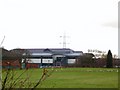
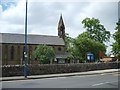


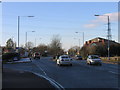
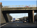
39 photos from this area
Area Information
Key information about the B62 0DU including its size, population, and administrative classification.
- Area Type
- Postcode
- Area Size
- 1.0 hectares
- Population
- 1755
- Population Density
- 3511 people/km²
House Prices in B62 0DU
20
Properties
£165,246
Average Sold Price
£7,500
Lowest Price
£342,000
Highest Price
Showing 20 properties
| Address | Type | Beds | Baths | Last Sale Price | Last Sale Date | |
|---|---|---|---|---|---|---|
| 89 Frankley Avenue, Halesowen, B62 0DU | Semi-detached | 2 | 1 | £272,500 | Sep 2023 | |
| 71 Frankley Avenue, Halesowen, B62 0DU | Semi-detached | 3 | 1 | £342,000 | Jul 2023 | |
| 87 Frankley Avenue, Halesowen, B62 0DU | Semi-detached | 2 | 1 | £220,000 | Jun 2023 | |
| 78 Frankley Avenue, Halesowen, B62 0DU | Detached | 3 | - | £7,500 | May 2018 | |
| 83 Frankley Avenue, Halesowen, B62 0DU | Semi-detached | 2 | 1 | £153,000 | Jun 2017 | |
| 99 Frankley Avenue, Halesowen, B62 0DU | Semi-detached | 2 | - | £162,950 | Aug 2016 | |
| 79 Frankley Avenue, Halesowen, B62 0DU | Semi-detached | 3 | - | £205,000 | Mar 2014 | |
| 69 Frankley Avenue, Halesowen, B62 0DU | Bungalow | 3 | 3 | £200,000 | Nov 2012 | |
| 85 Frankley Avenue, Halesowen, B62 0DU | house | 2 | - | £147,000 | Dec 2010 | |
| 73 Frankley Avenue, Halesowen, B62 0DU | Detached | 3 | 1 | £122,000 | May 2001 |
Page 1 of 2
Energy Efficiency in B62 0DU
Amenities
Schools
| Rank | School | Type | Entry gender | Ages |
|---|
Explore more schools in this area
Go to Schools tabDemographics
Household Size
Family (3-5 people)
most common
Accommodation Type
Houses
most common
Tenure
73
majority
Ethnic Group
White
most common
Religion
N/A
most common
Household Composition
N/A
most common
Age
47
median
Adults (30-64 years)
most common
Household Deprivation
N/A
with no deprivation
NS-SEC
35
in Lower managerial occupations
Explore more demographic insights in this area
Go to Demographics tabPlanning
Planning Constraints
- Flood RiskPremium
- Ramsar Wetland SitesPremium
- Area of Outstanding Natural BeautyPremium
- Protected Nature ReservePremium
- Protected WoodlandPremium