Area Overview for B61 9LS
Photos of B61 9LS
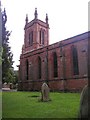


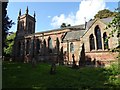
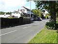
39 photos from this area
Area Information
Key information about the B61 9LS including its size, population, and administrative classification.
- Area Type
- Postcode
- Area Size
- 12.8 hectares
- Population
- 2207
- Population Density
- 84 people/km²
House Prices in B61 9LS
19
Properties
£282,717
Average Sold Price
£93,000
Lowest Price
£405,000
Highest Price
Showing 19 properties
| Address | Type | Beds | Baths | Last Sale Price | Last Sale Date | |
|---|---|---|---|---|---|---|
| 34 Stourbridge Road, Fairfield, B61 9LS | Detached | 3 | 1 | £405,000 | Feb 2023 | |
| 16 Stourbridge Road, Fairfield, B61 9LS | Semi-detached | 3 | - | £318,000 | May 2021 | |
| 24 Stourbridge Road, Fairfield, B61 9LS | house | 3 | - | £360,000 | Feb 2020 | |
| 18 Stourbridge Road, Fairfield, B61 9LS | house | 3 | 1 | £319,950 | Nov 2018 | |
| 10 Stourbridge Road, Fairfield, B61 9LS | Bungalow | 4 | - | £360,000 | Aug 2016 | |
| 40 Stourbridge Road, Fairfield, B61 9LS | Detached | 4 | 2 | £347,500 | Jul 2008 | |
| 42 Stourbridge Road, Fairfield, B61 9LS | Detached | - | - | £203,000 | Sep 2005 | |
| 20 Stourbridge Road, Fairfield, B61 9LS | Detached | - | - | £138,000 | Mar 1999 | |
| 22 Stourbridge Road, Fairfield, B61 9LS | Detached | - | - | £93,000 | Apr 1998 | |
| 30 Stourbridge Road, Fairfield, B61 9LS | Detached | 3 | 1 | - | - |
Page 1 of 2
Energy Efficiency in B61 9LS
Amenities
Schools
| Rank | School | Type | Entry gender | Ages |
|---|
Explore more schools in this area
Go to Schools tabDemographics
Household Size
Two person
most common
Accommodation Type
Houses
most common
Tenure
85
majority
Ethnic Group
White
most common
Religion
N/A
most common
Household Composition
N/A
most common
Age
47
median
Adults (30-64 years)
most common
Household Deprivation
N/A
with no deprivation
NS-SEC
44
in Lower managerial occupations
Explore more demographic insights in this area
Go to Demographics tabPlanning
Planning Constraints
- Flood RiskPremium
- Ramsar Wetland SitesPremium
- Area of Outstanding Natural BeautyPremium
- Protected Nature ReservePremium
- Protected WoodlandPremium