Area Overview for B61 9LR
Photos of B61 9LR
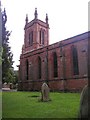


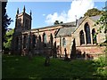
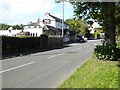
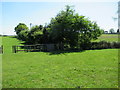
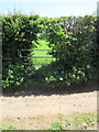
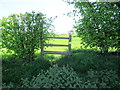
39 photos from this area
Area Information
Key information about the B61 9LR including its size, population, and administrative classification.
- Area Type
- Postcode
- Area Size
- 3.5 hectares
- Population
- 2207
- Population Density
- 84 people/km²
House Prices in B61 9LR
14
Properties
£363,740
Average Sold Price
£205,000
Lowest Price
£508,400
Highest Price
Showing 14 properties
| Address | Type | Beds | Baths | Last Sale Price | Last Sale Date | |
|---|---|---|---|---|---|---|
| 7 Stourbridge Road, Fairfield, B61 9LR | house | - | - | £430,000 | Sep 2022 | |
| 9 Stourbridge Road, Fairfield, B61 9LR | house | - | - | £430,000 | Jan 2022 | |
| 19 Stourbridge Road, Fairfield, B61 9LR | Bungalow | 3 | 2 | £508,400 | Apr 2020 | |
| 1 Stourbridge Road, Fairfield, B61 9LR | Detached | 3 | 1 | £475,000 | Jun 2019 | |
| 23 Stourbridge Road, Fairfield, B61 9LR | Bungalow | 3 | 2 | £380,000 | May 2017 | |
| 17 Stourbridge Road, Fairfield, B61 9LR | Detached | 4 | - | £498,000 | Sep 2013 | |
| 7A Stourbridge Road, Fairfield, B61 9LR | house | - | - | £250,000 | Aug 2009 | |
| 5 Stourbridge Road, Fairfield, B61 9LR | Detached | 3 | 1 | £216,000 | May 2005 | |
| 11 Stourbridge Road, Fairfield, B61 9LR | Terraced | - | - | £205,000 | Aug 2002 | |
| 21 Stourbridge Road, Fairfield, B61 9LR | Detached | - | - | £245,000 | Nov 2000 |
Page 1 of 2
Energy Efficiency in B61 9LR
Amenities
Schools
| Rank | School | Type | Entry gender | Ages |
|---|
Explore more schools in this area
Go to Schools tabDemographics
Household Size
Two person
most common
Accommodation Type
Houses
most common
Tenure
85
majority
Ethnic Group
White
most common
Religion
N/A
most common
Household Composition
N/A
most common
Age
47
median
Adults (30-64 years)
most common
Household Deprivation
N/A
with no deprivation
NS-SEC
44
in Lower managerial occupations
Explore more demographic insights in this area
Go to Demographics tabPlanning
Planning Constraints
- Flood RiskPremium
- Ramsar Wetland SitesPremium
- Area of Outstanding Natural BeautyPremium
- Protected Nature ReservePremium
- Protected WoodlandPremium