Area Overview for B61 7PG
Photos of B61 7PG
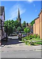
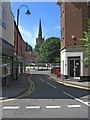
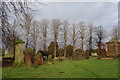
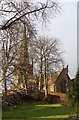
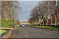
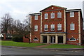
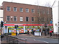
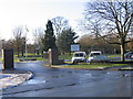
100 photos from this area
Area Information
Key information about the B61 7PG including its size, population, and administrative classification.
- Area Type
- Postcode
- Area Size
- 2.5 hectares
- Population
- 1668
- Population Density
- 2633 people/km²
House Prices in B61 7PG
11
Properties
£222,934
Average Sold Price
£84,950
Lowest Price
£325,000
Highest Price
Showing 11 properties
| Address | Type | Beds | Baths | Last Sale Price | Last Sale Date | |
|---|---|---|---|---|---|---|
| 85 Deansway, Bromsgrove, B61 7PG | Detached | 3 | 1 | £325,000 | Nov 2025 | |
| 83 Deansway, Bromsgrove, B61 7PG | Detached | 3 | 1 | £280,000 | Mar 2023 | |
| 93 Deansway, Bromsgrove, B61 7PG | Detached | 4 | - | £285,000 | Jun 2019 | |
| 97 Deansway, Bromsgrove, B61 7PG | house | 3 | - | £189,952 | Nov 2011 | |
| 79 Deansway, Bromsgrove, B61 7PG | house | 4 | - | £235,500 | Dec 2010 | |
| 81 Deansway, Bromsgrove, B61 7PG | Detached | - | - | £225,000 | Aug 2006 | |
| 91 Deansway, Bromsgrove, B61 7PG | Detached | - | - | £191,000 | Aug 2006 | |
| 95 Deansway, Bromsgrove, B61 7PG | house | - | - | £190,000 | Sep 2002 | |
| 89 Deansway, Bromsgrove, B61 7PG | Detached | - | - | £84,950 | Apr 1997 | |
| 87 Deansway, Bromsgrove, B61 7PG | Detached | 4 | 1 | - | - |
Page 1 of 2
Energy Efficiency in B61 7PG
Amenities
Schools
| Rank | School | Type | Entry gender | Ages |
|---|
Explore more schools in this area
Go to Schools tabDemographics
Household Size
Family (3-5 people)
most common
Accommodation Type
Houses
most common
Tenure
87
majority
Ethnic Group
White
most common
Religion
N/A
most common
Household Composition
N/A
most common
Age
47
median
Adults (30-64 years)
most common
Household Deprivation
N/A
with no deprivation
NS-SEC
36
in Lower managerial occupations
Explore more demographic insights in this area
Go to Demographics tabPlanning
Planning Constraints
- Flood RiskPremium
- Ramsar Wetland SitesPremium
- Area of Outstanding Natural BeautyPremium
- Protected Nature ReservePremium
- Protected WoodlandPremium