Area Overview for B61 7BS
Photos of B61 7BS
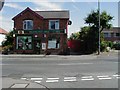
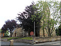
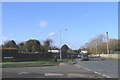
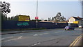
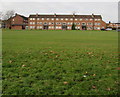
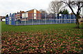
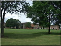
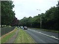
39 photos from this area
Area Information
Key information about the B61 7BS including its size, population, and administrative classification.
- Area Type
- Postcode
- Area Size
- 1.4 hectares
- Population
- 1648
- Population Density
- 2877 people/km²
House Prices in B61 7BS
25
Properties
£199,717
Average Sold Price
£82,000
Lowest Price
£283,000
Highest Price
Showing 25 properties
| Address | Type | Beds | Baths | Last Sale Price | Last Sale Date | |
|---|---|---|---|---|---|---|
| 26 Swift Close, Bromsgrove, B61 7BS | Semi-detached | 3 | 1 | £265,000 | Apr 2023 | |
| 22 Swift Close, Bromsgrove, B61 7BS | Semi-detached | 3 | 1 | £283,000 | Sep 2022 | |
| 16 Swift Close, Bromsgrove, B61 7BS | house | - | - | £247,000 | Aug 2021 | |
| 28 Swift Close, Bromsgrove, B61 7BS | Semi-detached | 3 | - | £245,000 | Jun 2021 | |
| 24 Swift Close, Bromsgrove, B61 7BS | Semi-detached | 3 | 1 | £240,000 | Mar 2021 | |
| 32 Swift Close, Bromsgrove, B61 7BS | house | 3 | - | £235,000 | Feb 2020 | |
| 14 Swift Close, Bromsgrove, B61 7BS | Semi-detached | 3 | 1 | £250,000 | Dec 2019 | |
| 18 Swift Close, Bromsgrove, B61 7BS | Semi-detached | 3 | 1 | £210,000 | Nov 2017 | |
| 20 Swift Close, Bromsgrove, B61 7BS | Semi-detached | 3 | 1 | £177,000 | Aug 2016 | |
| 15 Swift Close, Bromsgrove, B61 7BS | Semi-detached | 3 | - | £190,000 | Mar 2015 |
Page 1 of 3
Energy Efficiency in B61 7BS
Amenities
Schools
| Rank | School | Type | Entry gender | Ages |
|---|
Explore more schools in this area
Go to Schools tabDemographics
Household Size
Family (3-5 people)
most common
Accommodation Type
Houses
most common
Tenure
67
majority
Ethnic Group
White
most common
Religion
N/A
most common
Household Composition
N/A
most common
Age
47
median
Adults (30-64 years)
most common
Household Deprivation
N/A
with no deprivation
NS-SEC
35
in Lower managerial occupations
Explore more demographic insights in this area
Go to Demographics tabPlanning
Planning Constraints
- Flood RiskPremium
- Ramsar Wetland SitesPremium
- Area of Outstanding Natural BeautyPremium
- Protected Nature ReservePremium
- Protected WoodlandPremium