Area Overview for B61 7PA
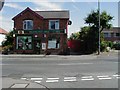
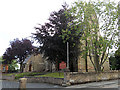
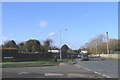
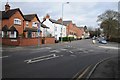
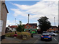
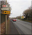
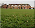
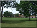
Photos of B61 7PA


Area Information
Living in B61 7PA means being part of a small, tightly knit residential cluster in England’s West Midlands. With a population of 1,648, this area is compact yet well-served by essential services. The community here skews towards middle-aged residents, with a median age of 47 and a majority of adults aged 30–64. This suggests a stable, family-oriented environment where many residents are likely to be established professionals or homeowners. The area’s housing stock is predominantly houses, reflecting a quieter, more private lifestyle compared to high-density developments. While no major landmarks or historical sites are explicitly detailed, the proximity to Bromsgrove and surrounding towns offers access to broader amenities without the need for long commutes. The low flood risk and absence of protected natural areas mean residents can enjoy a straightforward, low-constraint living experience. For those seeking a balance between suburban tranquillity and practical connectivity, B61 7PA provides a foundation of safety, accessibility, and community cohesion.
- Area Type
- Postcode
- Area Size
- Not available
- Population
- 1648
- Population Density
- 2877 people/km²
B61 7PA is a predominantly owner-occupied area, with 67% of homes owned by residents rather than rented. The housing stock is largely composed of houses, which are more common than flats or apartments in this postcode. This suggests a focus on private, family-friendly living spaces rather than high-density or rental-focused developments. The relatively small population and compact size of the area mean that the property market is likely limited to a handful of homes, with limited scope for new builds or speculative investment. For buyers, this implies a niche market where properties may hold value due to their rarity and the area’s low risk factors. However, the lack of large-scale development or commercial infrastructure means that the immediate surroundings may not offer the same growth potential as more urbanised regions.
House Prices in B61 7PA
No properties found in this postcode.
Energy Efficiency in B61 7PA
The lifestyle in B61 7PA is shaped by its proximity to retail and transport hubs. Within reach are five retail outlets, including major chains like Waitrose, Co-op, and Asda, offering a range of shopping options for groceries, household items, and more. These stores cater to daily needs, reducing the necessity for long trips to larger centres. The area’s rail connections, including Bromsgrove and Alvechurch stations, provide access to broader leisure and employment opportunities. While no parks or recreational facilities are explicitly listed, the absence of planning constraints like protected woodlands or AONBs suggests that residents may have access to open spaces in nearby towns. The combination of retail convenience, rail links, and low environmental restrictions creates a practical, low-maintenance lifestyle suited to those prioritising accessibility and stability.
Amenities
Schools
The nearest school to B61 7PA is Millfields First School, a primary school with a good Ofsted rating. This provides families with a reliable option for early education, though no secondary schools are listed in the data. The presence of a primary school with a positive rating suggests that the area is suitable for families with young children, offering a foundation for education without the need to travel far. However, parents seeking secondary schooling may need to look beyond the immediate vicinity, as no higher-level institutions are detailed. The single school listed reflects the area’s small size and focus on primary education, which aligns with the demographic profile of older, established residents.
| Rank | School | Type | Entry gender | Ages |
|---|
Explore more schools in this area
Go to Schools tabDemographics
The population of B61 7PA is characterised by a median age of 47, with the most common age range being adults aged 30–64. This indicates a mature, settled community where many residents are likely to be in their prime working years or nearing retirement. Home ownership is strong, with 67% of properties occupied by their owners, suggesting a stable housing market and long-term residency. The area’s accommodation is primarily houses, which aligns with the demographic profile of older, family-oriented households. The predominant ethnic group is White, though no further breakdown of diversity is provided. The absence of specific data on deprivation or income levels means that quality of life here is inferred from the low crime risk and robust digital connectivity. This combination of factors points to a community that prioritises security, comfort, and long-term investment in property.
Household Size
Accommodation Type
Tenure
Ethnic Group
Religion
Household Composition
Age
Household Deprivation
NS-SEC
Explore more demographic insights in this area
Go to Demographics tabPlanning
Planning Constraints
- Flood RiskPremium
- Ramsar Wetland SitesPremium
- Area of Outstanding Natural BeautyPremium
- Protected Nature ReservePremium
- Protected WoodlandPremium