Area Overview for B61 7AR
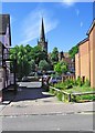
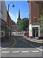
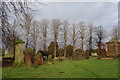
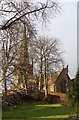
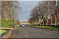
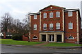
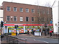
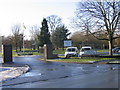
Photos of B61 7AR

Area Information
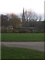
Living in B61 7AR means inhabiting a compact residential cluster in England’s West Midlands, where 2,038 people reside across just 1,863 square metres. This translates to a population density of over 1 million per square kilometre, a stark contrast to typical urban areas. The area’s small footprint suggests tightly packed housing, likely contributing to a close-knit community feel. While no major landmarks or infrastructure are explicitly detailed, the proximity to Bromsgrove’s amenities and transport hubs implies accessibility to services. The area’s demographics—skewed toward adults aged 30–64—suggest a mature population, possibly with established careers and families. Though no specific cultural or historical details are provided, the high density and limited space may shape daily life around shared resources and local interactions. For buyers, this postcode offers a snapshot of a densely populated, possibly older community with limited expansion potential, ideal for those prioritising convenience over space.
- Area Type
- Postcode
- Area Size
- 1863 m²
- Population
- 2038
- Population Density
- 2538 people/km²
The property market in B61 7AR is characterised by a 52% home ownership rate, with houses forming the primary accommodation type. This suggests a mix of owner-occupied and rental properties, though the small area size—just 1,863 square metres—limits the housing stock. The prevalence of houses over flats or apartments may appeal to buyers seeking family-friendly layouts or more space. However, the high population density implies competition for properties, potentially driving up prices. Given the area’s compact nature, buyers should consider proximity to amenities and transport as critical factors. The lack of detailed property price data means it’s unclear whether this is a growing or stagnant market, but the mix of ownership and rental options offers flexibility for different buyer needs.
House Prices in B61 7AR
No properties found in this postcode.
Energy Efficiency in B61 7AR
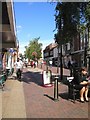
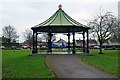
The lifestyle in B61 7AR is shaped by its proximity to retail and transport hubs. Five retail venues, including Waitrose and Asda, provide easy access to groceries, clothing, and household goods. The five nearby railway stations—Bromsgrove, Barnt Green, and Alvechurch—offer connections to major cities, facilitating both daily commutes and weekend excursions. While no parks or leisure facilities are explicitly listed within the postcode, the surrounding area likely includes green spaces, as seen in nearby Bromsgrove. The compact nature of the area means amenities are within walking or short driving distance, fostering convenience. However, the lack of specific recreational venues in the data suggests residents may rely on nearby towns for leisure activities.
Amenities
Schools
Residents of B61 7AR have access to three schools within practical reach. St John’s CofE Foundation Middle School is a primary school, while Bromsgrove School is an independent institution, likely offering fee-based education. St John’s Church of England Middle School Academy, an academy with a ‘good’ Ofsted rating, provides state-funded secondary education. This mix of school types offers families choice: state education for affordability or independent options for specialised curricula. The presence of an academy with a strong rating may attract families prioritising academic standards, while the independent school caters to those seeking alternative educational models. However, no data on school catchment areas or pupil performance is provided, so proximity alone does not guarantee admission.
| Rank | School | Type | Entry gender | Ages |
|---|
Explore more schools in this area
Go to Schools tabDemographics
B61 7AR’s population of 2,038 is dominated by adults aged 30–64, with a median age of 47. This suggests a community of middle-aged residents, likely in their peak earning years or retired. Home ownership sits at 52%, indicating that nearly half of properties are owner-occupied, while the remainder are likely rented. The accommodation type is predominantly houses, which may appeal to families or those seeking more space than flats. The predominant ethnic group is White, though no data on minority representation is provided. The high population density—over 1 million people per square kilometre—raises questions about living conditions, though no specific deprivation metrics are included. For quality of life, the mix of age groups and housing types may support a stable, if compact, community.
Household Size
Accommodation Type
Tenure
Ethnic Group
Religion
Household Composition
Age
Household Deprivation
NS-SEC
Explore more demographic insights in this area
Go to Demographics tabPlanning
Planning Constraints
- Flood RiskPremium
- Ramsar Wetland SitesPremium
- Area of Outstanding Natural BeautyPremium
- Protected Nature ReservePremium
- Protected WoodlandPremium