Area Overview for B61 0NJ
Photos of B61 0NJ
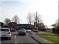
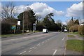

44 photos from this area
Area Information
Key information about the B61 0NJ including its size, population, and administrative classification.
- Area Type
- Postcode
- Area Size
- 1.1 hectares
- Population
- 1745
- Population Density
- 1819 people/km²
House Prices in B61 0NJ
29
Properties
£179,138
Average Sold Price
£86,500
Lowest Price
£325,000
Highest Price
Showing 29 properties
| Address | Type | Beds | Baths | Last Sale Price | Last Sale Date | |
|---|---|---|---|---|---|---|
| 24 The Dock, Catshill, B61 0NJ | Detached | 4 | 2 | £325,000 | Oct 2024 | |
| 25 The Dock, Catshill, B61 0NJ | Terraced | 2 | 1 | £130,600 | Feb 2024 | |
| 5 The Dock, Catshill, B61 0NJ | Terraced | 3 | 1 | £230,000 | Feb 2023 | |
| 23 The Dock, Catshill, B61 0NJ | house | 2 | 1 | £172,000 | Oct 2020 | |
| 1 The Dock, Catshill, B61 0NJ | Terraced | 3 | 1 | £155,000 | Jun 2017 | |
| 27 The Dock, Catshill, B61 0NJ | Detached | 4 | 1 | £226,500 | Mar 2015 | |
| 26 The Dock, Catshill, B61 0NJ | Semi-detached | - | - | £86,500 | Oct 1999 | |
| Dimensions (uk), 30 The Dock, Catshill, B61 0NJ | house | - | - | £107,500 | Sep 1999 | |
| The Annexe, 27 The Dock, Catshill, B61 0NJ | Flat | - | - | - | - | |
| Catshill Clinic, 17 The Dock, Catshill, B61 0NJ | commercial | - | - | - | - |
Page 1 of 3
Energy Efficiency in B61 0NJ
Amenities
Schools
| Rank | School | Type | Entry gender | Ages |
|---|
Explore more schools in this area
Go to Schools tabDemographics
Household Size
Two person
most common
Accommodation Type
Houses
most common
Tenure
78
majority
Ethnic Group
White
most common
Religion
N/A
most common
Household Composition
N/A
most common
Age
47
median
Adults (30-64 years)
most common
Household Deprivation
N/A
with no deprivation
NS-SEC
36
in Lower managerial occupations
Explore more demographic insights in this area
Go to Demographics tabPlanning
Planning Constraints
- Flood RiskPremium
- Ramsar Wetland SitesPremium
- Area of Outstanding Natural BeautyPremium
- Protected Nature ReservePremium
- Protected WoodlandPremium