Area Overview for B61 0NF
Photos of B61 0NF
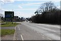
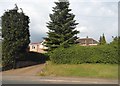
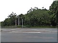
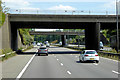
44 photos from this area
Area Information
Key information about the B61 0NF including its size, population, and administrative classification.
- Area Type
- Postcode
- Area Size
- 5.5 hectares
- Population
- 1375
- Population Density
- 2820 people/km²
House Prices in B61 0NF
35
Properties
£142,367
Average Sold Price
£82,500
Lowest Price
£210,000
Highest Price
Showing 35 properties
| Address | Type | Beds | Baths | Last Sale Price | Last Sale Date | |
|---|---|---|---|---|---|---|
| 62 Spenser Walk, Catshill, B61 0NF | Terraced | 3 | 1 | £200,000 | Sep 2025 | |
| 40 Spenser Walk, Catshill, B61 0NF | Terraced | 3 | 1 | £165,000 | Dec 2023 | |
| 18 Spenser Walk, Catshill, B61 0NF | Terraced | 3 | 1 | £210,000 | May 2023 | |
| 32 Spenser Walk, Catshill, B61 0NF | Terraced | 3 | 1 | £192,000 | Jun 2022 | |
| 22 Spenser Walk, Catshill, B61 0NF | Terraced | 3 | 1 | £179,000 | Aug 2021 | |
| 58 Spenser Walk, Catshill, B61 0NF | Terraced | 3 | 1 | £149,000 | Jul 2019 | |
| 70 Spenser Walk, Catshill, B61 0NF | Terraced | 3 | 1 | £128,000 | Jan 2018 | |
| 2 Spenser Walk, Catshill, B61 0NF | Terraced | 3 | 2 | £137,000 | Apr 2017 | |
| 26 Spenser Walk, Catshill, B61 0NF | Terraced | 3 | 1 | £130,000 | Jan 2017 | |
| 4 Spenser Walk, Catshill, B61 0NF | Terraced | 3 | 1 | £130,000 | Sep 2015 |
Page 1 of 4
Energy Efficiency in B61 0NF
Amenities
Schools
| Rank | School | Type | Entry gender | Ages |
|---|
Explore more schools in this area
Go to Schools tabDemographics
Household Size
One person
most common
Accommodation Type
Houses
most common
Tenure
61
majority
Ethnic Group
White
most common
Religion
N/A
most common
Household Composition
N/A
most common
Age
47
median
Adults (30-64 years)
most common
Household Deprivation
N/A
with no deprivation
NS-SEC
30
in Lower managerial occupations
Explore more demographic insights in this area
Go to Demographics tabPlanning
Planning Constraints
- Flood RiskPremium
- Ramsar Wetland SitesPremium
- Area of Outstanding Natural BeautyPremium
- Protected Nature ReservePremium
- Protected WoodlandPremium