Area Overview for B60 4ND
Photos of B60 4ND
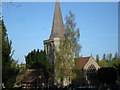

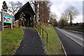
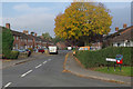
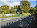
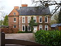
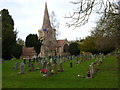
43 photos from this area
Area Information
Key information about the B60 4ND including its size, population, and administrative classification.
- Area Type
- Postcode
- Area Size
- 2.9 hectares
- Population
- 1275
- Population Density
- 1788 people/km²
House Prices in B60 4ND
45
Properties
£155,800
Average Sold Price
£45,000
Lowest Price
£275,000
Highest Price
Showing 45 properties
| Address | Type | Beds | Baths | Last Sale Price | Last Sale Date | |
|---|---|---|---|---|---|---|
| 42 Ryefields Road, Stoke Prior, B60 4ND | Terraced | 3 | 1 | £210,000 | Mar 2024 | |
| 32 Ryefields Road, Stoke Prior, B60 4ND | Semi-detached | 3 | 1 | £275,000 | Jan 2024 | |
| 38 Ryefields Road, Stoke Prior, B60 4ND | house | - | - | £104,000 | Jun 2022 | |
| 50 Ryefields Road, Stoke Prior, B60 4ND | Terraced | 3 | 1 | £210,000 | Mar 2022 | |
| 44 Ryefields Road, Stoke Prior, B60 4ND | Terraced | - | - | £145,000 | Mar 2019 | |
| 36 Ryefields Road, Stoke Prior, B60 4ND | Semi-detached | 3 | 1 | £190,000 | Nov 2018 | |
| 46 Ryefields Road, Stoke Prior, B60 4ND | Terraced | 3 | - | £135,000 | Jul 2014 | |
| 37 Ryefields Road, Stoke Prior, B60 4ND | house | 4 | - | £162,000 | May 2014 | |
| 19 Ryefields Road, Stoke Prior, B60 4ND | house | - | - | £45,000 | Feb 2003 | |
| 34 Ryefields Road, Stoke Prior, B60 4ND | house | - | - | £82,000 | Jun 2000 |
Page 1 of 5
Energy Efficiency in B60 4ND
Amenities
Schools
| Rank | School | Type | Entry gender | Ages |
|---|
Explore more schools in this area
Go to Schools tabDemographics
Household Size
Two person
most common
Accommodation Type
Houses
most common
Tenure
72
majority
Ethnic Group
White
most common
Religion
N/A
most common
Household Composition
N/A
most common
Age
47
median
Adults (30-64 years)
most common
Household Deprivation
N/A
with no deprivation
NS-SEC
35
in Lower managerial occupations
Explore more demographic insights in this area
Go to Demographics tabPlanning
Planning Constraints
- Flood RiskPremium
- Ramsar Wetland SitesPremium
- Area of Outstanding Natural BeautyPremium
- Protected Nature ReservePremium
- Protected WoodlandPremium