Area Overview for B60 4LZ
Photos of B60 4LZ
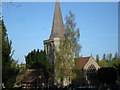
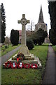
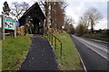
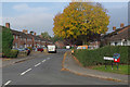
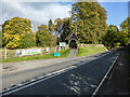
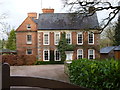
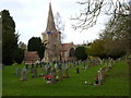
43 photos from this area
Area Information
Key information about the B60 4LZ including its size, population, and administrative classification.
- Area Type
- Postcode
- Area Size
- 2.9 hectares
- Population
- 1275
- Population Density
- 1788 people/km²
House Prices in B60 4LZ
64
Properties
£161,569
Average Sold Price
£73,000
Lowest Price
£275,000
Highest Price
Showing 64 properties
| Address | Type | Beds | Baths | Last Sale Price | Last Sale Date | |
|---|---|---|---|---|---|---|
| 12 Walls Road, Stoke Prior, B60 4LZ | Semi-detached | 3 | 2 | £275,000 | Dec 2023 | |
| 9 Walls Road, Stoke Prior, B60 4LZ | Terraced | 3 | 2 | £240,000 | Jul 2022 | |
| 61 Walls Road, Stoke Prior, B60 4LZ | house | - | - | £240,000 | Jul 2022 | |
| 37A Walls Road, Stoke Prior, B60 4LZ | Detached | 2 | 1 | £247,000 | Jun 2021 | |
| 47 Walls Road, Stoke Prior, B60 4LZ | house | - | - | £130,000 | Mar 2021 | |
| 55 Walls Road, Stoke Prior, B60 4LZ | house | - | - | £209,569 | Aug 2018 | |
| 34 Walls Road, Stoke Prior, B60 4LZ | Semi-detached | 3 | - | £195,000 | Feb 2018 | |
| 1 Walls Road, Stoke Prior, B60 4LZ | house | 3 | - | £126,666 | Dec 2017 | |
| 13 Walls Road, Stoke Prior, B60 4LZ | Terraced | 3 | - | £189,000 | Oct 2015 | |
| 11 Walls Road, Stoke Prior, B60 4LZ | Terraced | 3 | 1 | £187,000 | Oct 2015 |
Page 1 of 7
Energy Efficiency in B60 4LZ
Amenities
Schools
| Rank | School | Type | Entry gender | Ages |
|---|
Explore more schools in this area
Go to Schools tabDemographics
Household Size
Two person
most common
Accommodation Type
Houses
most common
Tenure
72
majority
Ethnic Group
White
most common
Religion
N/A
most common
Household Composition
N/A
most common
Age
47
median
Adults (30-64 years)
most common
Household Deprivation
N/A
with no deprivation
NS-SEC
35
in Lower managerial occupations
Explore more demographic insights in this area
Go to Demographics tabPlanning
Planning Constraints
- Flood RiskPremium
- Ramsar Wetland SitesPremium
- Area of Outstanding Natural BeautyPremium
- Protected Nature ReservePremium
- Protected WoodlandPremium