Area Overview for B60 3LB
Photos of B60 3LB
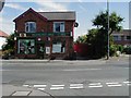
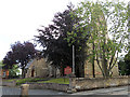
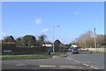
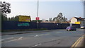
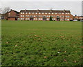
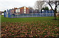
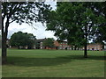
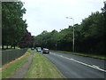
39 photos from this area
Area Information
Key information about the B60 3LB including its size, population, and administrative classification.
- Area Type
- Postcode
- Area Size
- 1.6 hectares
- Population
- 2011
- Population Density
- 5091 people/km²
House Prices in B60 3LB
69
Properties
£154,433
Average Sold Price
£70,000
Lowest Price
£258,000
Highest Price
Showing 69 properties
| Address | Type | Beds | Baths | Last Sale Price | Last Sale Date | |
|---|---|---|---|---|---|---|
| 128 Lyttleton Avenue, Bromsgrove, B60 3LB | Semi-detached | 3 | 1 | £205,000 | Aug 2025 | |
| 106 Lyttleton Avenue, Bromsgrove, B60 3LB | Semi-detached | 2 | 1 | £235,000 | Feb 2024 | |
| 126 Lyttleton Avenue, Bromsgrove, B60 3LB | Semi-detached | 3 | 1 | £258,000 | Aug 2022 | |
| 124 Lyttleton Avenue, Bromsgrove, B60 3LB | Semi-detached | 3 | 1 | £179,950 | Mar 2018 | |
| 104 Lyttleton Avenue, Bromsgrove, B60 3LB | Semi-detached | 2 | 2 | £115,000 | Dec 2014 | |
| 114 Lyttleton Avenue, Bromsgrove, B60 3LB | house | 2 | - | £117,000 | Aug 2012 | |
| 210 Lyttleton Avenue, Bromsgrove, B60 3LB | Flat | - | - | £85,000 | Jul 2006 | |
| 110 Lyttleton Avenue, Bromsgrove, B60 3LB | Semi-detached | - | - | £124,950 | Sep 2004 | |
| 102 Lyttleton Avenue, Bromsgrove, B60 3LB | Semi-detached | 2 | - | £70,000 | Dec 2001 | |
| 6, Lyttleton Court, Lyttleton Avenue, Bromsgrove, B60 3LB | Flat | - | - | - | - |
Page 1 of 7
Energy Efficiency in B60 3LB
Amenities
Schools
| Rank | School | Type | Entry gender | Ages |
|---|
Explore more schools in this area
Go to Schools tabDemographics
Household Size
One person
most common
Accommodation Type
Houses
most common
Tenure
51
majority
Ethnic Group
White
most common
Religion
N/A
most common
Household Composition
N/A
most common
Age
47
median
Adults (30-64 years)
most common
Household Deprivation
N/A
with no deprivation
NS-SEC
22
in Lower managerial occupations
Explore more demographic insights in this area
Go to Demographics tabPlanning
Planning Constraints
- Flood RiskPremium
- Ramsar Wetland SitesPremium
- Area of Outstanding Natural BeautyPremium
- Protected Nature ReservePremium
- Protected WoodlandPremium