Area Overview for B60 2LE
Photos of B60 2LE
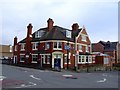
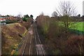
100 photos from this area
Area Information
Key information about the B60 2LE including its size, population, and administrative classification.
- Area Type
- Postcode
- Area Size
- 4034 m²
- Population
- 1317
- Population Density
- 5714 people/km²
House Prices in B60 2LE
17
Properties
£224,244
Average Sold Price
£146,000
Lowest Price
£377,975
Highest Price
Showing 17 properties
| Address | Type | Beds | Baths | Last Sale Price | Last Sale Date | |
|---|---|---|---|---|---|---|
| 130 New Road, Bromsgrove, B60 2LE | Semi-detached | 3 | 1 | £377,975 | Sep 2022 | |
| Hills Lodge, New Road, Bromsgrove, B60 2LE | Detached | - | - | £220,000 | Jul 2016 | |
| 138 New Road, Bromsgrove, B60 2LE | house | 3 | - | £153,000 | Feb 2014 | |
| 136 New Road, Bromsgrove, B60 2LE | house | 3 | - | £146,000 | Nov 2012 | |
| 146 New Road, Bromsgrove, B60 2LE | Detached | 3 | 2 | - | - | |
| Flat 2, Hills Court, 146A New Road, Bromsgrove, B60 2LE | Flat | 1 | 1 | - | - | |
| First Floor Flat, 144 New Road, Bromsgrove, B60 2LE | Flat | 2 | 1 | - | - | |
| 148B New Road, Bromsgrove, B60 2LE | Flat | - | - | - | - | |
| Flat 1, Hills Court, 146A New Road, Bromsgrove, B60 2LE | Flat | - | - | - | - | |
| Ascotts, 148 New Road, Bromsgrove, B60 2LE | restaurant_cafe | - | - | - | - |
Page 1 of 2
Energy Efficiency in B60 2LE
Amenities
Schools
| Rank | School | Type | Entry gender | Ages |
|---|
Explore more schools in this area
Go to Schools tabDemographics
Household Size
One person
most common
Accommodation Type
Houses
most common
Tenure
62
majority
Ethnic Group
White
most common
Religion
N/A
most common
Household Composition
N/A
most common
Age
47
median
Adults (30-64 years)
most common
Household Deprivation
N/A
with no deprivation
NS-SEC
48
in Lower managerial occupations
Explore more demographic insights in this area
Go to Demographics tabPlanning
Planning Constraints
- Flood RiskPremium
- Ramsar Wetland SitesPremium
- Area of Outstanding Natural BeautyPremium
- Protected Nature ReservePremium
- Protected WoodlandPremium