Area Overview for B60 2LD
Photos of B60 2LD
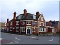

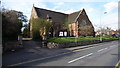
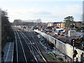


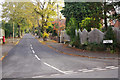
100 photos from this area
Area Information
Key information about the B60 2LD including its size, population, and administrative classification.
- Area Type
- Postcode
- Area Size
- 9402 m²
- Population
- 1904
- Population Density
- 3722 people/km²
House Prices in B60 2LD
23
Properties
£315,000
Average Sold Price
£125,500
Lowest Price
£457,500
Highest Price
Showing 23 properties
| Address | Type | Beds | Baths | Last Sale Price | Last Sale Date | |
|---|---|---|---|---|---|---|
| 114 New Road, Bromsgrove, B60 2LD | Retail | 5 | 2 | £457,500 | Apr 2022 | |
| 126 New Road, Bromsgrove, B60 2LD | Semi-detached | 3 | 1 | £315,000 | Jun 2021 | |
| 122 New Road, Bromsgrove, B60 2LD | Detached | 4 | 1 | £380,000 | Jul 2014 | |
| 116 New Road, Bromsgrove, B60 2LD | Semi-detached | 4 | - | £285,000 | Feb 2014 | |
| 120 New Road, Bromsgrove, B60 2LD | Semi-detached | - | - | £327,000 | Aug 2007 | |
| 118 New Road, Bromsgrove, B60 2LD | Semi-detached | - | - | £125,500 | Apr 1999 | |
| Flat 12, Marlborough Court, 108 New Road, Bromsgrove, B60 2LD | Flat | 2 | 1 | - | - | |
| Flat 2, Marlborough Court, 108 New Road, Bromsgrove, B60 2LD | Flat | 2 | 1 | - | - | |
| Flat 8, Marlborough Court, 108 New Road, Bromsgrove, B60 2LD | Flat | 2 | 1 | - | - | |
| 112 New Road, Bromsgrove, B60 2LD | Semi-detached | 4 | 2 | - | - |
Page 1 of 3
Energy Efficiency in B60 2LD
Amenities
Schools
| Rank | School | Type | Entry gender | Ages |
|---|
Explore more schools in this area
Go to Schools tabDemographics
Household Size
Family (3-5 people)
most common
Accommodation Type
Houses
most common
Tenure
88
majority
Ethnic Group
White
most common
Religion
N/A
most common
Household Composition
N/A
most common
Age
47
median
Adults (30-64 years)
most common
Household Deprivation
N/A
with no deprivation
NS-SEC
45
in Lower managerial occupations
Explore more demographic insights in this area
Go to Demographics tabPlanning
Planning Constraints
- Flood RiskPremium
- Ramsar Wetland SitesPremium
- Area of Outstanding Natural BeautyPremium
- Protected Nature ReservePremium
- Protected WoodlandPremium