Area Overview for B60 1BD
Photos of B60 1BD
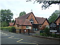
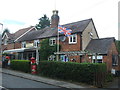
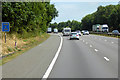

32 photos from this area
Area Information
Key information about the B60 1BD including its size, population, and administrative classification.
- Area Type
- Postcode
- Area Size
- 1.7 hectares
- Population
- 1267
- Population Density
- 1032 people/km²
House Prices in B60 1BD
34
Properties
£299,875
Average Sold Price
£5,250
Lowest Price
£575,000
Highest Price
Showing 34 properties
| Address | Type | Beds | Baths | Last Sale Price | Last Sale Date | |
|---|---|---|---|---|---|---|
| 4 Gleneagles Drive, Blackwell, B60 1BD | house | 5 | 1 | £575,000 | Feb 2025 | |
| 1 Gleneagles Drive, Blackwell, B60 1BD | Bungalow | 2 | 1 | £365,000 | Feb 2023 | |
| 31 Gleneagles Drive, Blackwell, B60 1BD | Detached | 4 | 2 | £412,500 | Feb 2021 | |
| 38 Gleneagles Drive, Blackwell, B60 1BD | Detached | 4 | 2 | £385,000 | Jan 2021 | |
| 10 Gleneagles Drive, Blackwell, B60 1BD | Detached | 4 | 3 | £450,000 | Dec 2020 | |
| 15 Gleneagles Drive, Blackwell, B60 1BD | Detached | - | - | £5,250 | Oct 2019 | |
| 17 Gleneagles Drive, Blackwell, B60 1BD | Detached | 3 | 2 | £295,000 | Jan 2019 | |
| 30 Gleneagles Drive, Blackwell, B60 1BD | Detached | 4 | 2 | £420,000 | May 2018 | |
| 11 Gleneagles Drive, Blackwell, B60 1BD | Detached | 4 | 3 | £375,000 | Mar 2018 | |
| 6 Gleneagles Drive, Blackwell, B60 1BD | Bungalow | - | - | £287,000 | Mar 2017 |
Page 1 of 4
Energy Efficiency in B60 1BD
Amenities
Schools
| Rank | School | Type | Entry gender | Ages |
|---|
Explore more schools in this area
Go to Schools tabDemographics
Household Size
Family (3-5 people)
most common
Accommodation Type
Houses
most common
Tenure
94
majority
Ethnic Group
White
most common
Religion
N/A
most common
Household Composition
N/A
most common
Age
47
median
Adults (30-64 years)
most common
Household Deprivation
N/A
with no deprivation
NS-SEC
55
in Lower managerial occupations
Explore more demographic insights in this area
Go to Demographics tabPlanning
Planning Constraints
- Flood RiskPremium
- Ramsar Wetland SitesPremium
- Area of Outstanding Natural BeautyPremium
- Protected Nature ReservePremium
- Protected WoodlandPremium