Area Overview for B60 1BB
Photos of B60 1BB
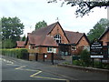
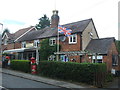
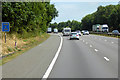

32 photos from this area
Area Information
Key information about the B60 1BB including its size, population, and administrative classification.
- Area Type
- Postcode
- Area Size
- 3.1 hectares
- Population
- 1267
- Population Density
- 1032 people/km²
House Prices in B60 1BB
43
Properties
£355,456
Average Sold Price
£112,000
Lowest Price
£630,000
Highest Price
Showing 43 properties
| Address | Type | Beds | Baths | Last Sale Price | Last Sale Date | |
|---|---|---|---|---|---|---|
| 3 Fairways Drive, Blackwell, B60 1BB | Detached | 4 | - | £620,000 | Jul 2025 | |
| 18 Fairways Drive, Blackwell, B60 1BB | Detached | 4 | 3 | £630,000 | Jan 2025 | |
| 42 Fairways Drive, Blackwell, B60 1BB | Detached | 6 | 3 | £590,000 | Sep 2024 | |
| 45 Fairways Drive, Blackwell, B60 1BB | Retail | 4 | 2 | £495,000 | Jul 2022 | |
| 36 Fairways Drive, Blackwell, B60 1BB | house | - | - | £450,000 | Dec 2021 | |
| 29 Fairways Drive, Blackwell, B60 1BB | house | - | - | £430,000 | Jun 2021 | |
| 41 Fairways Drive, Blackwell, B60 1BB | Detached | 4 | 3 | £575,000 | May 2021 | |
| 27 Fairways Drive, Blackwell, B60 1BB | Detached | 4 | - | £465,000 | Dec 2020 | |
| 33 Fairways Drive, Blackwell, B60 1BB | Bungalow | 2 | 1 | £310,000 | Sep 2020 | |
| 28 Fairways Drive, Blackwell, B60 1BB | Bungalow | 2 | 1 | £425,000 | May 2019 |
Page 1 of 5
Energy Efficiency in B60 1BB
Amenities
Schools
| Rank | School | Type | Entry gender | Ages |
|---|
Explore more schools in this area
Go to Schools tabDemographics
Household Size
Family (3-5 people)
most common
Accommodation Type
Houses
most common
Tenure
94
majority
Ethnic Group
White
most common
Religion
N/A
most common
Household Composition
N/A
most common
Age
47
median
Adults (30-64 years)
most common
Household Deprivation
N/A
with no deprivation
NS-SEC
55
in Lower managerial occupations
Explore more demographic insights in this area
Go to Demographics tabPlanning
Planning Constraints
- Flood RiskPremium
- Ramsar Wetland SitesPremium
- Area of Outstanding Natural BeautyPremium
- Protected Nature ReservePremium
- Protected WoodlandPremium