Area Overview for B50 4AL
Photos of B50 4AL
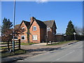

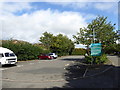

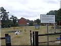
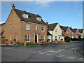
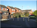

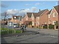

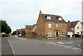

28 photos from this area
Area Information
Key information about the B50 4AL including its size, population, and administrative classification.
- Area Type
- Postcode
- Area Size
- 3.1 hectares
- Population
- 2070
- Population Density
- 511 people/km²
House Prices in B50 4AL
64
Properties
£274,941
Average Sold Price
£73,500
Lowest Price
£560,000
Highest Price
Showing 64 properties
| Address | Type | Beds | Baths | Last Sale Price | Last Sale Date | |
|---|---|---|---|---|---|---|
| 72 Westholme Road, Bidford On Avon, B50 4AL | Bungalow | 2 | 1 | £560,000 | Nov 2022 | |
| 63 Westholme Road, Bidford On Avon, B50 4AL | Bungalow | 3 | 2 | £415,000 | May 2022 | |
| 30 Westholme Road, Bidford On Avon, B50 4AL | house | 4 | - | £425,000 | Mar 2020 | |
| 41 Westholme Road, Bidford On Avon, B50 4AL | Bungalow | 4 | 2 | £420,000 | Oct 2019 | |
| 42 Westholme Road, Bidford On Avon, B50 4AL | house | - | - | £400,000 | Nov 2016 | |
| 34 Westholme Road, Bidford On Avon, B50 4AL | Bungalow | 3 | 2 | £338,000 | Oct 2016 | |
| Trevellas, 57 Westholme Road, Bidford On Avon, B50 4AL | Bungalow | - | - | £243,000 | Oct 2015 | |
| Westholme, 28 Westholme Road, Bidford On Avon, B50 4AL | house | 4 | 1 | £395,000 | Sep 2011 | |
| 59 Westholme Road, Bidford On Avon, B50 4AL | Bungalow | 3 | - | £294,000 | Feb 2011 | |
| 65 Westholme Road, Bidford On Avon, B50 4AL | Bungalow | - | - | £267,000 | Sep 2010 |
Page 1 of 7
Energy Efficiency in B50 4AL
Amenities
Schools
| Rank | School | Type | Entry gender | Ages |
|---|
Explore more schools in this area
Go to Schools tabDemographics
Household Size
Two person
most common
Accommodation Type
Houses
most common
Tenure
83
majority
Ethnic Group
White
most common
Religion
N/A
most common
Household Composition
N/A
most common
Age
47
median
Adults (30-64 years)
most common
Household Deprivation
N/A
with no deprivation
NS-SEC
43
in Lower managerial occupations
Explore more demographic insights in this area
Go to Demographics tabPlanning
Planning Constraints
- Flood RiskPremium
- Ramsar Wetland SitesPremium
- Area of Outstanding Natural BeautyPremium
- Protected Nature ReservePremium
- Protected WoodlandPremium